Grand Blanc, Michigan
| Grand Blanc | |
|---|---|
| City | |
| Nickname(s): GB | |
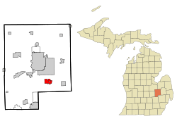 Location of Grand Blanc, Michigan | |
| Coordinates: 42°55′38″N 83°37′23″W / 42.92722°N 83.62306°W | |
| Country | United States |
| State | Michigan |
| County | Genesee |
| Settled | 1823 |
| Incorporated (city) | March 4, 1930 |
| Government | |
| • Type | council-manager[1] |
| • Mayor | Susan J. Soderstrom |
| • City Manager | Paul J. Brake[1] |
| Area[2] | |
| • Total | 3.63 sq mi (9.40 km2) |
| • Land | 3.61 sq mi (9.35 km2) |
| • Water | 0.02 sq mi (0.05 km2) 0.55% |
| Elevation | 837 ft (255 m) |
| Population (2010)[3] | |
| • Total | 8,276 |
| • Estimate (2016)[4] | 7,954 |
| • Density | 2,300/sq mi (880/km2) |
| Time zone | UTC-5 (EST) |
| • Summer (DST) | UTC-4 (EDT) |
| ZIP code | 48439, 48480 |
| Area code(s) | 810 |
| FIPS code | 26-33280[5] |
| GNIS feature ID | 0627081[6] |
| Website |
cityofgrandblanc |
Grand Blanc is a city in Genesee County in the U.S. state of Michigan and a suburb of Flint. Grand Blanc is situated within Grand Blanc Township, but it is administratively autonomous. The population was 8,144 as of the 2010 US Census.
History
The unincorporated village of Grand Blanc, or Grumlaw, was a former Indian campground first settled by Jacob Stevens in spring 1822. Several years later, settlers improved the Indian trail to Saginaw; they laid out and staked it in 1829 as Saginaw Road.[7]
By 1916, the community (population 400) had a grade school, a private bank, flour mill, an elevator, a creamery, and two churches, the Methodist Episcopal and the Congregational. The community was equipped with electrical lighting.[7]
A ballot question in the May 2, 2006 Genesee County general election ended governmental research into a plan to consolidate the city and township governments; 68.62% of city voters opposed consolidation efforts whereas 31.38% were in favor.[8]
Notable people
- Rob Paulsen, voice actor
- Grant Fisher, track athlete
- Chuck Forrest, Jeopardy! winner
Geography
According to the United States Census Bureau, the city has a total area of 3.63 square miles (9.40 km2), of which, 3.61 square miles (9.35 km2) is land and 0.02 square miles (0.05 km2) is water.[2]
Demographics
| Historical population | |||
|---|---|---|---|
| Census | Pop. | %± | |
| 1880 | 216 | — | |
| 1930 | 917 | — | |
| 1940 | 1,012 | 10.4% | |
| 1950 | 998 | −1.4% | |
| 1960 | 1,565 | 56.8% | |
| 1970 | 5,132 | 227.9% | |
| 1980 | 6,848 | 33.4% | |
| 1990 | 7,760 | 13.3% | |
| 2000 | 8,242 | 6.2% | |
| 2010 | 8,276 | 0.4% | |
| Est. 2016 | 7,954 | [4] | −3.9% |
| U.S. Decennial Census[9] | |||
As of the 2000 US Census (the latest year for which data is available), the median income for a household in the city was $54,099, and the median income for a family was $82,456. Males had a median income of $61,522 versus $31,051 for females. The per capita income for the city was $32,622. About 3.7% of families and 5.5% of the population were below the poverty line, including 6.3% of those under age 18 and 3.9% of those age 65 or over.
2010 census
As of the 2010 US Census,[10] there were 8,276 people, 3,566 households, and 2,158 families residing in the city. The population density was 2,177.9 per square mile (844.5/km²). There were 3,784 housing units at an average density of 995.8 per square mile (386.1/km²). The racial makeup of the city was 82.5% White, 11.1% African American, 0.4% Native American, 2.8% Asian, 0.4% from other races, and 2.9% from two or more races. Hispanic or Latino of any race were 2.6% of the population.
Of 3566 households, 28.9% had children under the age of 18 living with them, 43.4% were married couples living together, 13.0% had a female householder with no husband present, and 39.5% were non-families. 34.0% of all households were made up of individuals and 12.9% had someone living alone who was 65 years of age or older. The average household size was 2.28 and the average family size was 2.94.
The city's population as of 2010 census data was 53.7% female and 46.3% male. The median age was 39.1 years and the population exhibits a bimodal age distribution with peak age groups at 10-14 and 45–49 years (7.5% and 7.2%, respectively).
Government
The city has a council-manager form of government.[1] The municipality operates its own water system.[11]
The city is served by various specialized units of government:
- Grand Blanc Community Schools[12]
- Genesee District Library, which has a branch location, Grand Blanc-McFarlen, in the city[13]
- Fourth Division B of the 67th District Court of the State of Michigan.[14]
References
- 1 2 3 Schuch, Sarah (July 12, 2012). "Grand Blanc City Council approves raise for city manager". Flint Journal. Retrieved April 11, 2014.
- 1 2 "US Gazetteer files 2010". United States Census Bureau. Archived from the original on 2012-01-24. Retrieved 2012-11-25.
- ↑ "American FactFinder". United States Census Bureau. Retrieved 2012-11-25.
- 1 2 "Population and Housing Unit Estimates". Retrieved June 9, 2017.
- ↑ "American FactFinder". United States Census Bureau. Archived from the original on 2013-09-11. Retrieved 2008-01-31.
- ↑ "US Board on Geographic Names". United States Geological Survey. 2007-10-25. Retrieved 2008-01-31.
- 1 2 Wood, Edwin O. (1916). "XXVI: Villages of Genesee County, Part I". History of Genesee County, Michigan, Her People, Industries and Institutions. US GenNet. Retrieved April 11, 2014.
- ↑ "Summary Report | Regular Election | Official Results". Genesee County Clerk's Office. Archived from the original on 2 January 2014. Retrieved 7 January 2012.
- ↑ "Census of Population and Housing". Census.gov. Archived from the original on May 12, 2015. Retrieved June 4, 2015.
- ↑ "Profile of General Population and Housing Characteristics: 2010". 2010 United States Census. US Census Bureau. Archived from the original on 11 September 2013. Retrieved 7 January 2012.
- ↑ Adams, Dominic (June 27, 2014). "Flint monthly water and sewer bills highest in Genesee County by $35". The Flint Journal. Mlive Media Group. Retrieved April 2, 2015.
- ↑ Shively, J. "Genesee ISD" (PDF). Michigan Center for Geographic Information. State of Michigan. Retrieved 17 October 2011.
- ↑ "Branch Locations". The Genesee District Library. Retrieved April 11, 2014.
- ↑ "Grand Blanc Court". 67th District Court. County of Genesee. Retrieved April 11, 2014.
External links
Municipalities and communities of Genesee County, Michigan, United States | ||
|---|---|---|
| Cities | 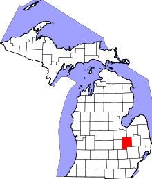 | |
| Villages | ||
| Charter townships | ||
| General law townships | ||
| Unincorporated communities | ||
| Footnotes | ‡This populated place also has portions in an adjacent county or counties | |
Coordinates: 42°55′39″N 83°37′48″W / 42.92750°N 83.63000°W