Lake Fenton, Michigan
| Lake Fenton, Michigan | |
|---|---|
| Census-designated place | |
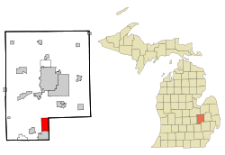 Location of Lake Fenton within Genesee County, Michigan | |
| Coordinates: 42°50′46″N 83°42′28″W / 42.84611°N 83.70778°WCoordinates: 42°50′46″N 83°42′28″W / 42.84611°N 83.70778°W | |
| Country | United States |
| State | Michigan |
| County | Genesee |
| Township | Fenton |
| Government | |
| • Type | None (see: Township) |
| Area | |
| • Total | 7.2 sq mi (18.6 km2) |
| • Land | 5.5 sq mi (14.3 km2) |
| • Water | 1.7 sq mi (4.4 km2) 23.51% |
| Elevation | 879 ft (268 m) |
| Population (2010) | |
| • Total | 5,559 |
| • Density | 1,009/sq mi (389.7/km2) |
| Time zone | UTC-5 (EST) |
| • Summer (DST) | UTC-4 (EDT) |
| ZIP codes | 48430 (Fenton), 48451 (Linden), 48439 (Grand Blanc) |
| Area code(s) | 810 |
| FIPS code | 26-44520[1] |
| GNIS feature ID | 1867319[2] |
Lake Fenton is a census-designated place (CDP) in Fenton Charter Township, Genesee County in the U.S. state of Michigan.[3] As of the 2010 census the population was 5,559,[4] up from 4,876 at the 2000 census. The CDP includes the unincorporated communities of Bayport Park and Lakeside.
The Lake Fenton Community Schools district overlaps a portion of this and adjacent areas. The school district and community are named after Lake Fenton, formerly known as Long Lake. A community was platted as "Mount Pleasant" by John Cook in 1840, with a second plat added in 1845. The name was changed to "Long Lake" in 1850, and a post office with that name opened on March 6, 1851. The lake was subsequently renamed "Lake Fenton", and the platted settlement became extinct.[5] In 1932, the United States Board on Geographic Names decided on "Lake Fenton" as the official name of the lake.[6]
Astronaut Michael J. Bloomfield grew up in Lake Fenton (his address was officially Linden, Michigan, and he was born in Flint).
Communities
- Lakeside is an unincorporated community on the east side of Lake Fenton at 42°50′09″N 83°42′24″W / 42.83583°N 83.70667°W,[7] a short distance north of Fenton.
- Bayport Park is an unincorporated community on the north side of Lake Fenton at 42°51′15″N 83°43′04″W / 42.85417°N 83.71778°W with elevation at 889 feet (271 meters).[8]
Geography
The Lake Fenton CDP occupies the northeast corner of Fenton Township, bordered to the north by Mundy Township, to the west by the rest of Fenton Township, to the south by the city of Fenton, and to the east by Holly Township in Oakland County. All but the southern end of Lake Fenton, the water body, is located within the Lake Fenton CDP; the southern end of the lake is in the city of Fenton. Other lakes in the CDP include Petts Lake, Crooked Lake, McCully Lake, Dollar Lake, Little Long Lake, and Barnum Lake. According to the United States Census Bureau, the CDP has a total area of 7.2 square miles (18.6 km2), of which 5.5 square miles (14.3 km2) is land and 1.7 square miles (4.4 km2), or 23.51%, is water.[4]
From the center of the Lake Fenton CDP, it is 3.5 miles (5.6 km) south to the center of Fenton city, and 12 miles (19 km) north to downtown Flint, via Fenton Road.
Demographics
As of the census[1] of 2000, there were 4,876 people, 1,886 households, and 1,433 families residing in the CDP. The population density is 884.3 per square mile (341.7/km²). There are 2,076 housing units at an average density of 376.5 per square mile (145.5/km²). The racial makeup of the CDP is 97.09% White, 0.25% Black or African American, 0.45% Native American, 0.66% Asian, 0.02% Pacific Islander, 0.27% from other races, and 1.27% from two or more races. 1.39% of the population are Hispanic or Latino of any race.
There are 1,886 households out of which 31.2% have children under the age of 18 living with them, 64.8% are married couples living together, 7.2% have a female householder with no husband present, and 24.0% are non-families. 19.5% of all households are made up of individuals and 6.2% have someone living alone who is 65 years of age or older. The average household size is 2.58 and the average family size is 2.97.
In the CDP, the population is spread out with 23.6% under the age of 18, 7.1% from 18 to 24, 29.0% from 25 to 44, 29.2% from 45 to 64, and 11.1% who are 65 years of age or older. The median age is 40 years. For every 100 females there are 102.7 males. For every 100 females age 18 and over, there are 102.0 males.
The median income for a household in the CDP is $67,885, and the median income for a family is $82,366. Males have a median income of $54,559 versus $32,804 for females. The per capita income for the CDP is $32,717. 3.2% of the population and 1.0% of families are below the poverty line. Out of the total population, 1.1% of those under the age of 18 and 4.7% of those 65 and older are living below the poverty line.
References
- 1 2 "American FactFinder". United States Census Bureau. Retrieved 2008-01-31.
- ↑ U.S. Geological Survey Geographic Names Information System: Lake Fenton, Michigan
- ↑ U.S. Geological Survey Geographic Names Information System: Lake Fenton Census Designated Place
- 1 2 "Geographic Identifiers: 2010 Demographic Profile Data (G001): Lake Fenton CDP, Michigan". American Factfinder. U.S. Census Bureau. Retrieved December 16, 2016.
- ↑ Romig, Walter (1986) [1973]. Michigan Place Names. Detroit, Michigan: Wayne State University Press. ISBN 0-8143-1838-X.
- ↑ U.S. Geological Survey Geographic Names Information System: Lake Fenton (lake)
- ↑ U.S. Geological Survey Geographic Names Information System: Lakeside, Michigan
- ↑ U.S. Geological Survey Geographic Names Information System: Bayport Park, Michigan
Municipalities and communities of Genesee County, Michigan, United States | ||
|---|---|---|
| Cities | 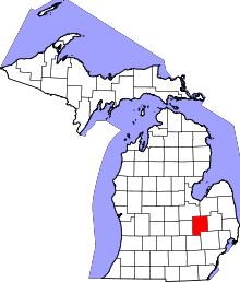 | |
| Villages | ||
| Charter townships | ||
| General law townships | ||
| Unincorporated communities | ||
| Footnotes | ‡This populated place also has portions in an adjacent county or counties | |