Gradac, Split-Dalmatia County
| Gradac Labineca | |
|---|---|
| Town | |
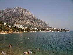 Gradac | |
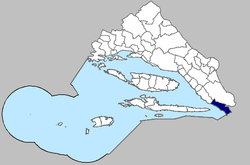
 Gradac Location of Gradac within Croatia | |
| Coordinates: 43°06′17″N 17°20′28″E / 43.10472°N 17.34111°E | |
| Country | Croatia |
| County | Split-Dalmatia County |
| Government | |
| • Municipal mayor | Matko Burić (SDP) |
| • Municipal Council |
13 members[1]
|
| Area[2] | |
| • Total | 49 km2 (19 sq mi) |
| Population (2011)[3] | |
| • Total | 1,308 |
| Time zone | UTC+1 (CET) |
| • Summer (DST) | UTC+2 (CEST) |
| Postal code | 21300 |
| Area code(s) | 021 |
| Website |
opcinagradac |
Gradac (pronounced [ɡrǎːdats]); Italian: Labinezza, is the southernmost tourist locality of the Makarska riviera in southern Dalmatia, Croatia. It is situated halfway between Split and Dubrovnik. The city of Ploče is 12 km south of Gradac, while the city of Makarska is 42 km north. The town of Gradac is a center of a municipality which consists of the places: Brist, Drvenik (Makarska), Gradac, Podaca and Zaostrog and marks the end of the riviera.[4]
History
The Gradac area was inhabited before prehistoric times. Numerous stone mounds dating back to the Bronze and Early Iron Ages have been found in the area. In Roman times, the Gradac area was most likely the seat of the Roman civitas Biston, which as a coastal center belonged to the colony of Narona, an important Roman stronghold on what is now Croatian territory.
At the locality of Gradina a cornice fragment of the monumental building from the 2nd-3rd century was found, as well as Roman coin pieces. Near the Laguna hotel were found many tombs, hence it is thought that on this location there was once a Roman necropolis.
The medieval town of Lapčan, or Labinac, which, under the name of Labineca, was mentioned by the Byzantine emperor Constantine VII Porphyrogenitus, mid-10th century, was situated on the territory of today's Gradac.
Under its present name, Gradac was mentioned for the first time in 1649. It was named after the stronghold that was situated on the elevation above the present-day church of St. Michael, and which was built probably during the Cretan War (1645–1669) as a defence against the Turks.[5] According to the drawing made by the Venetian military engineer and cartographer Giuseppe Santini, representing the naval and continental battles between the Venetians and Ottomans at Gradac in the year 1666, the tower is shown in flames.
Culture
The remnants of the old tower from the 16th century can be found in the abandoned village of Čista above Gradac, the seat of the ancient Fragostin's district.
Surrounding it are still the remnants of rows of abandoned houses with typical architectonic features of the region. One of the oldest existing edifices in the territory of Gradac is the chapel of St. Pasquale on the Mt. Plana, with a barrel shaped vault, and a saddle roof.
Next to the old parish church of St. Antonio there is a local cemetery and the new parish church of St. Michael built in 1852, precisely in the zone of Gradina, the ancient Roman locality. In the church, there are three marble altars with statues. The most interesting among them is the old wooden statue of St. Rocco. In the church there is also the old baptismal stone font, originating probably from the old church.
Gradac is very well known for it antifascist and partisan history. Gradac has a memorial to citizens killed by the Yugoslav Partisans during World War II[6] Before war in the 1990s, Gradac had a memorial statue of an unknown soldier made by well-known Croatian sculptor Antun Augustinčić dedicated to partisan uprising during Second World War. It was destroyed in 1992.[7]
See also
References
- ↑ http://opcinagradac.hr/hr/34/opcinsko-vijece/
- ↑ "Općine Splitsko - dalmatinske županije". dalmacija.hr (in Croatian). Split-Dalmatia County. Archived from the original on 22 August 2015. Retrieved 25 August 2015.
- ↑ "Population by Age and Sex, by Settlements, 2011 Census: Gradac". Census of Population, Households and Dwellings 2011. Zagreb: Croatian Bureau of Statistics. December 2012.
- ↑ Jane Foster, Footprint Croatia, pg. 233, Footprint Handbooks (2004), ISBN 1-903471-79-6
- ↑ Radovan Radovinovič, The Croatian Adriatic Tourist Guide, pg. 306, Naklada Naprijed - Zagreb (1999), ISBN 953-178-097-8
- ↑ Gradac: uspomena na partizanske žrtve, Slobodna Dalmacija. August 6, 2010. Accessed August 7, 2010.
- ↑ "Priče o spomenicima" (in Croatian). Retrieved 29 May 2017.
External links
| Wikimedia Commons has media related to Gradac, Croatia. |
- Weather forecast for Gradac at AccuWeather.com
Subdivisions of Split-Dalmatia County | ||
|---|---|---|
| Cities and towns |  | |
| Municipalities |
| |
Coordinates: 43°06′17″N 17°20′28″E / 43.10472°N 17.34111°E