Grabow, Saxony-Anhalt
| Grabow | ||
|---|---|---|
| Stadtteil of Möckern | ||
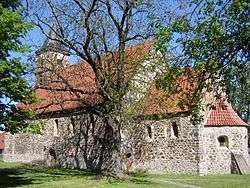 Church | ||
| ||
 Grabow Location of Grabow within Jerichower Land 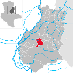 | ||
| Coordinates: 52°15′0″N 11°56′59″E / 52.25000°N 11.94972°ECoordinates: 52°15′0″N 11°56′59″E / 52.25000°N 11.94972°E | ||
| Country | Germany | |
| State | Saxony-Anhalt | |
| District | Jerichower Land | |
| Town | Möckern | |
| Area | ||
| • Total | 32.01 km2 (12.36 sq mi) | |
| Elevation | 51 m (167 ft) | |
| Population (2006-12-31) | ||
| • Total | 715 | |
| • Density | 22/km2 (58/sq mi) | |
| Time zone | CET/CEST (UTC+1/+2) | |
| Postal codes | 39291 | |
| Dialling codes | 03921 | |
| Vehicle registration | JL | |

Grabow is a village and a former municipality in the Jerichower Land district, in Saxony-Anhalt, Germany.[1] Since 1 January 2010, it is part of the town Möckern.
References
This article is issued from
Wikipedia.
The text is licensed under Creative Commons - Attribution - Sharealike.
Additional terms may apply for the media files.