Goulais Bay
| Goulais Bay | |
|---|---|
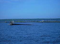 Goulais Bay at the mouth of the Goulais River | |
 Goulais Bay Location within Ontario | |
| Location | Algoma District, Ontario |
| Coordinates | 46°42′48″N 84°28′54″W / 46.7133°N 84.4817°WCoordinates: 46°42′48″N 84°28′54″W / 46.7133°N 84.4817°W |
| Part of | Whitefish Bay |
| Primary inflows | Goulais River |
Goulais Bay is a bay of Ontario in Canada.[1] It is part of Whitefish Bay which in turn is a large bay of Lake Superior. Goulais Point, on the southern-most tip of the peninsula that separates the bay from Batchawana Bay just to the north and from Whitefish Bay to the west, marks the northern entrance of Goulais Bay. North Gros Cap is the rock point that forms the bay's southern limit.[2]
The dispersed rural community of Goulais Bay is near the mouth of the Goulais River that empties into the bay's east side.[3] On the western shore of the bay is the community of Goulais Mission.[4]
See also
References
- ↑ "Goulais Bay". Geographical Names Data Base. Natural Resources Canada.
- ↑ United States War Dept. (1894). Annual Report of the Secretary of War. U.S. Government Printing Office. p. 3408. Retrieved 26 September 2018.
- ↑ "Goulais Bay (community)". Geographical Names Data Base. Natural Resources Canada.
- ↑ "Goulais Mission". Geographical Names Data Base. Natural Resources Canada.
External links

This article is issued from
Wikipedia.
The text is licensed under Creative Commons - Attribution - Sharealike.
Additional terms may apply for the media files.