Goreljce
| Goreljce | |
|---|---|
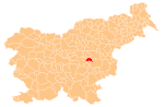
 Goreljce Location in Slovenia | |
| Coordinates: 46°1′51.4″N 15°12′11.97″E / 46.030944°N 15.2033250°ECoordinates: 46°1′51.4″N 15°12′11.97″E / 46.030944°N 15.2033250°E | |
| Country |
|
| Traditional region | Lower Carniola |
| Statistical region | Lower Sava |
| Municipality | Radeče |
| Area | |
| • Total | 1.12 km2 (0.43 sq mi) |
| Elevation | 469.7 m (1,541.0 ft) |
| Population (2002) | |
| • Total | 57 |
| [1] | |
Goreljce (pronounced [ɡɔˈɾeːltsɛ]; in older sources also Gorelice[2]) is a small dispersed settlement in the Municipality of Radeče in eastern Slovenia. It lies in the hills south of Radeče in the historical region of Lower Carniola. The municipality is now included in the Lower Sava Statistical Region; until January 2014 it was part of the Savinja Statistical Region.[3]
References
- ↑ Statistical Office of the Republic of Slovenia
- ↑ Leksikon občin kraljestev in dežel zastopanih v državnem zboru, vol. 6: Kranjsko. 1906. Vienna: C. Kr. Dvorna in Državna Tiskarna, p. 88.
- ↑ Radeče municipal site
External links
| Settlements | Administrative centre: Radeče
|  | ||||
|---|---|---|---|---|---|---|
| Landmarks |
| |||||
This article is issued from
Wikipedia.
The text is licensed under Creative Commons - Attribution - Sharealike.
Additional terms may apply for the media files.