Golosón International Airport
| Golosón International Airport Aeropuerto Internacional Golosón La Ceiba Airport Hector C. Moncada Air Base | |||||||||||
|---|---|---|---|---|---|---|---|---|---|---|---|
 | |||||||||||
| Summary | |||||||||||
| Airport type | Military/Public | ||||||||||
| Operator | InterAirports | ||||||||||
| Serves | La Ceiba, Honduras | ||||||||||
| Elevation AMSL | 49 ft / 15 m | ||||||||||
| Coordinates | 15°44′34″N 086°51′08″W / 15.74278°N 86.85222°WCoordinates: 15°44′34″N 086°51′08″W / 15.74278°N 86.85222°W | ||||||||||
| Map | |||||||||||
 LCE Location in Honduras | |||||||||||
| Runways | |||||||||||
| |||||||||||
| Statistics (2014) | |||||||||||
| |||||||||||
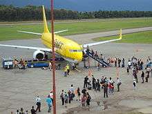
Golosón International Airport (Spanish: Aeropuerto Internacional Golosón) (IATA: LCE, ICAO: MHLC) is an airport located on the western side of the city of La Ceiba, in the Atlántida Department on the north coast of Honduras. It is also known as La Ceiba Airport (Aeropuerto de La Ceiba) and Hector C. Moncada Air Base (Base Aérea Hector C. Moncada).
Facilities
The airport resides at an elevation of 15 m (49 ft) above mean sea level. It has one runway designated 07/25 with an asphalt surface measuring 2,950 by 45 metres (9,678 ft × 148 ft).[1] Runway length includes a 250 metres (820 ft) displaced threshold on Runway 07.
There is distant mountainous terrain south of the airport.
The La Cieba NDB-DME (Ident: LCE) is located 2.2 nautical miles (4.1 km) west of the airport. The Bonito VOR-DME (Ident: BTO) is located on the field.[4][5]
Airlines and destinations
| Airlines | Destinations |
|---|---|
| AeroCaribe de Honduras | Puerto Lempira Airport, Roatan, Guanaja |
| Aerolineas Sosa | Brus Laguna, Grand Cayman, Guanaja, Puerto Lempira Airport, Roatan, San Pedro Sula, Tegucigalpa, Útila Airport Charter: Cancún |
| Cayman Airways | Grand Cayman |
| Lanhsa Airlines | Guanaja, Roatan, Puerto Lempira Airport, Útila Airport |
| SAP Honduras | Charter: Bay Islands, Belize City, Cancun, Cozumel, Puerto Lempira Airport, San Pedro Sula, San Salvador, Tapachula, Tegucigalpa |
Cargo
| Airlines | Destinations |
|---|---|
| DHL Aero Expreso | Seasonal: Miami |
See also
References
- 1 2 MHLC – GOLOSÓN Internacional Cocesna.org
- ↑ "Goloson Internacional Airport". SkyVector. Retrieved 28 September 2018.
- ↑ Airport information for Golosón International Airport at Great Circle Mapper.
- ↑ "La Ceiba NDB". Our Airports. Retrieved 28 September 2018.
- ↑ "Bonito VOR". Our Airports. Retrieved 28 September 2018.
External links
- OpenStreetMap - La Ceiba
- Current weather for MHLC at NOAA/NWS
- Accident history for La Ceiba-Goloson International Airport at Aviation Safety Network
- Google Maps - La Ceiba
- Memoria de Sostenibilidad 2014-2015 - InterAirports, S.A. (in Spanish)