Gochas
| Gochas | |
|---|---|
| Village | |
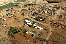
 Aerial view of Gochas (2017) | |
 Gochas | |
| Coordinates: 24°47′S 18°49′E / 24.783°S 18.817°ECoordinates: 24°47′S 18°49′E / 24.783°S 18.817°E | |
| Country |
|
| Time zone | UTC+2 (South African Standard Time) |
| Climate | BWh |
Gochas aerial view (2017)
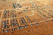
Gochas North aerial view (2017)
Gochas is a village in the Hardap Region of Namibia. It is located 110 kilometres (68 mi) southeast of Mariental[1] on the way to the Mata Mata border post to the Kgalagadi Transfrontier Park.[2] The village has been the main settlement of the ǃKharakhoen (Fransman Nama), a subtribe of the Nama people,[3] since 1889.[4]
Politics
Gochas is governed by a village council that currently has five seats.[5]
The 2015 local authority election was won by the SWAPO party which gained three seats (326 votes). One seat each was won by the Congress of Democrats (CoD, 96 votes) and the Democratic Turnhalle Alliance (DTA, 36 votes).[6]
References
- ↑ Cloete, Luqman (24 November 2005). "Ministry takes up probe of problems at Gochas". The Namibian.
- ↑ "Gochas". Namibweb. Retrieved 10 July 2011.
- ↑ Malan, Johan S (1998). Die Völker Namibias [The Tribes of Namibia] (in German). Windhoek, Göttingen: Klaus Hess. pp. 120–125.
- ↑ Dierks, Klaus. "Biographies of Namibian Personalities, K". Retrieved 9 July 2011.
- ↑ "Know Your Local Authority". Election Watch (3). Institute for Public Policy Research. 2015. p. 4.
- ↑ "Local elections results". Electoral Commission of Namibia. 28 November 2015. p. 2.
This article is issued from
Wikipedia.
The text is licensed under Creative Commons - Attribution - Sharealike.
Additional terms may apply for the media files.