Tay Valley, Ontario
| Tay Valley | |
|---|---|
| Township (lower-tier) | |
| Township of Tay Valley | |
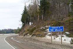 Road sign along Highway 7 | |
 Tay Valley | |
| Coordinates: 44°52′N 76°23′W / 44.867°N 76.383°WCoordinates: 44°52′N 76°23′W / 44.867°N 76.383°W | |
| Country |
|
| Province |
|
| County | Lanark |
| Incorporated | January 1, 1998 |
| Government | |
| • Type | Township |
| • Reeve | Keith Kerr |
| • Gov. Body | Tay Valley Township Council |
| • Federal riding | Lanark—Frontenac—Lennox and Addington |
| • Prov. riding | Lanark—Frontenac—Lennox and Addington |
| Area | |
| • Land | 549.12 km2 (212.02 sq mi) |
| Population (2011) | |
| • Total | 5,571 |
| • Density | 10.1/km2 (26/sq mi) |
| Time zone | UTC-5 (EST) |
| • Summer (DST) | UTC-4 (EDT) |
| Area code(s) | 613 |
| Website | www.tayvalleytwp.ca |
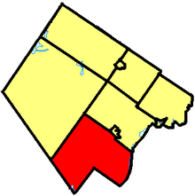
Tay Valley is a township in eastern Ontario, Canada, on the Tay River in the southwest corner of Lanark County, adjacent to the United Counties of Leeds and Grenville and Frontenac County. The township administrative offices are located in Glen Tay.
History
The township was incorporated on January 1, 1998 by amalgamating the former townships of Bathurst, South Sherbrooke and North Burgess. It was originally known as the township of Bathurst Burgess Sherbrooke, but adopted the name of Tay Valley on July 30, 2002. The Canadian Pacific Railway's original mainline (CP Havelock Subdivision) passed through Glen Tay heading west to Havelock then on to Toronto before being abandoned to Tweed in 1973 and to Havelock in 1987. A newer mainline was branched off west of Glen Tay southwest towards Belleville which still handles the CP Rail traffic from Smith Falls to Toronto.
Communities
The township comprises the communities of Althorpe, Bathurst Station, Bells Corners, Bolingbroke, Bolingbroke Siding, Brooke, Christie Lake, DeWitts Corners, Elliot, Fallbrook, Feldspar, Glen Tay, Harper, Maberly, Playfairville, Pratt Corners, Scotch Line, Stanleyville and Wemyss.
The permanent population was 5,571 in the 2011 census. However, similar to adjacent townships, there are also numerous seasonal residents, predominantly cottagers from Ottawa or Kingston. The total population including seasonal residents is estimated over 10,000, in 3,843 households.[1]
Demographics
| Canada census – Tay Valley, Ontario community profile | |||
|---|---|---|---|
| 2011 | 2006 | ||
| Population: | 5571 (-1.1% from 2006) | 5634 (3.6% from 2001) | |
| Land area: | 549.12 km2 (212.02 sq mi) | 527.46 km2 (203.65 sq mi) | |
| Population density: | 10.1/km2 (26/sq mi) | 10.7/km2 (28/sq mi) | |
| Median age: | 45.8 (M: 45.8, F: 45.8) | ||
| Total private dwellings: | 3698 | 3511 | |
| Median household income: | $66,082 | ||
| References: 2011[2] 2006[3] earlier[4] | |||
Population:[5]
- Population in 2011: 5571
- Population in 2006: 5634
- Population in 2001: 5440
- Population in 1996:
- Bathurst Township: 3179
- North Burgess Township: 1269
- South Sherbrooke Township: 732
- Population in 1991:
- Bathurst Township: 2888
- North Burgess Township: 1021
- South Sherbrooke Township: 669
Mother tongue:[3]
- English as first language: 94.5%
- French as first language: 3%
- English and French as first language: 0%
- Other as first language: 2.5%
Transportation
The main road in the township is the east-west Highway 7. The Rideau Trail passes through the township, including Murphys Point Provincial Park.
See also
References
- ↑ "Tay Valley Township PSB Reports to Council 2012/2013" (PDF). Tay Valley Police Services Board. Retrieved 25 April 2018.
- ↑ "2011 Community Profiles". Canada 2011 Census. Statistics Canada. July 5, 2013. Retrieved 2012-02-15.
- 1 2 "2006 Community Profiles". Canada 2006 Census. Statistics Canada. March 30, 2011. Retrieved 2012-02-15.
- ↑ "2001 Community Profiles". Canada 2001 Census. Statistics Canada. February 17, 2012.
- ↑ Statistics Canada: 1996, 2001, 2006 census
Places adjacent to Tay Valley, Ontario | |
|---|---|