Glen Finart
| Glen Finart | |
|---|---|
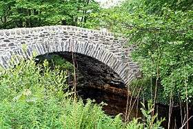 Barnacabber Bridge - geograph.org.uk - 430131 | |
| Highest point | |
| Coordinates | Coordinates: 56°03′36″N 4°55′30″W / 56.060°N 4.925°W grid reference NS1732090102 |
| Geography | |
| Location | Cowal, Argyll and Bute, Scotland |
| Country | Scotland |
| Geology | |
| Mountain type | Glen |
Glen Finart (Scottish Gaelic: Gleann Fhionnaird) is a glacially formed glen on the Cowal peninsula, Argyll and Bute, Scotland. The glen is within the Argyll Forest Park that is itself within the Loch Lomond and The Trossachs National Park.[1][2]
Glen Finart runs northwest, from Finart Bay and Ardentinny on the west shore of Loch Long, following the Finart Burn.[3]
Glenfinart House, a Grade B listed house, was destroyed by a fire in the 1960s; the only remaining part of the house is the tower.[4]
References
External links
- Map sources for Glen Finart
- Argyll Forest Park - website
- / Map of Argyll Forest Park
- Glen Finart on Gaelic place names of Scotland database
| Wikimedia Commons has media related to Glen Finart. |
This article is issued from
Wikipedia.
The text is licensed under Creative Commons - Attribution - Sharealike.
Additional terms may apply for the media files.