Glen Aulin
| Glen Aulin | |
|---|---|
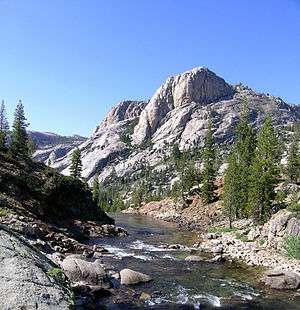 The Tuolumne River just above Glen Aulin | |
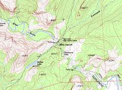 Topographic Map of the Glen Aulin area | |
| Floor elevation | 7,800 ft (2,400 m)[1] |
| Long-axis length | 1 mile (1.6 km) |
| Geography | |
| Coordinates | 37°54′42″N 119°25′29″W / 37.91167°N 119.42472°WCoordinates: 37°54′42″N 119°25′29″W / 37.91167°N 119.42472°W[1] |
Glen Aulin is a segment of the Tuolumne River valley, upriver from the Grand Canyon of the Tuolumne. Glen Aulin is home to the Glen Aulin High Sierra Camp. The name of the valley, meaning "beautiful valley" in Irish Gaelic, was suggested by James McCormick of the United States Geographic Board to R.B. Marshall of the USGS.[2]
References
- 1 2 U.S. Geological Survey Geographic Names Information System: Glen Aulin
- ↑ Farquhar, Francis P. (1926). "G". Place Names of the High Sierra. San Francisco: Sierra Club.
This article is issued from
Wikipedia.
The text is licensed under Creative Commons - Attribution - Sharealike.
Additional terms may apply for the media files.