Glazier, Texas
| Glazier, Texas | |
|---|---|
| Unincorporated community | |
 Glazier  Glazier | |
| Coordinates: 36°0′41″N 100°15′49″W / 36.01139°N 100.26361°WCoordinates: 36°0′41″N 100°15′49″W / 36.01139°N 100.26361°W | |
| Country | United States |
| State | Texas |
| County | Hemphill |
| Elevation | 2,615 ft (797 m) |
| Time zone | UTC-6 (Central (CST)) |
| • Summer (DST) | UTC-5 (CDT) |
| GNIS feature ID | 1358051 |
Glazier is an unincorporated community in Hemphill County, Texas, United States. It lies at the intersection of U.S. Highway 60 and State Highway 305, to the northeast of the city of Canadian, the county seat of Hemphill County.[1] Its elevation is 2,615 feet (797 m).[2] Local addresses are served by the 79014 ZIP code of the post office in Canadian.[3][4] Every structure in Glazier except one house was destroyed by a violent tornado on April 9, 1947, and 17 people were killed.[5][6][7]
Climate
According to the Köppen Climate Classification system, Glazier has a semi-arid climate, abbreviated "BSk" on climate maps.[8]
Gallery
.jpg) Glazier 1904-1918.
Glazier 1904-1918.
References
- ↑ Rand McNally. The Road Atlas '06. Chicago: Rand McNally, 2006, p. 98.
- ↑ U.S. Geological Survey Geographic Names Information System: Glazier, Texas, Geographic Names Information System, 1979-11-30. Accessed 2007-12-29.
- ↑ Zip Code Lookup
- ↑ Zip Code Lookup
- ↑ http://www.srh.noaa.gov/ama/?n=1947tornado
- ↑ "Archived copy". Archived from the original on 2009-12-01. Retrieved 2010-05-30.
- ↑ Associated Press, "Fear Casualty List to Grow; Towns Afire: Texas Village Razed", Chicago Daily Tribune, Chicago, Illinois, Thursday 10 April 1947, Volume CVI, Number 86, Section 1, Page 1.
- ↑ Climate Summary for Glazier, Texas
Municipalities and communities of Hemphill County, Texas, United States | ||
|---|---|---|
| City | 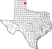 | |
| Unincorporated communities | ||
This article is issued from
Wikipedia.
The text is licensed under Creative Commons - Attribution - Sharealike.
Additional terms may apply for the media files.