Gierstädt
| Gierstädt | |
|---|---|
 Gierstädt Location of Gierstädt within Gotha district 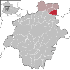  | |
| Coordinates: 51°2′35″N 10°49′38″E / 51.04306°N 10.82722°ECoordinates: 51°2′35″N 10°49′38″E / 51.04306°N 10.82722°E | |
| Country | Germany |
| State | Thuringia |
| District | Gotha |
| Municipal assoc. | Fahner Höhe |
| Government | |
| • Mayor | Ulf Henniger (CDU) |
| Area | |
| • Total | 10.62 km2 (4.10 sq mi) |
| Elevation | 245 m (804 ft) |
| Population (2017-12-31)[1] | |
| • Total | 828 |
| • Density | 78/km2 (200/sq mi) |
| Time zone | CET/CEST (UTC+1/+2) |
| Postal codes | 99100 |
| Dialling codes | 036206 |
| Vehicle registration | GTH |
| Website | www.vg-fahner-hoehe.de |
Gierstädt is a municipality in the district of Gotha, in Thuringia, Germany.
References
This article is issued from
Wikipedia.
The text is licensed under Creative Commons - Attribution - Sharealike.
Additional terms may apply for the media files.