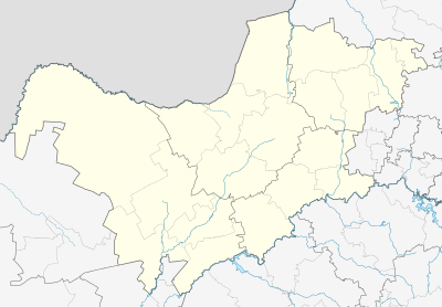
Geysdorp
| Geysdorp | |
|---|---|
 Geysdorp  Geysdorp Geysdorp (South Africa)  Geysdorp Geysdorp (Africa) | |
| Coordinates: 26°31′59″S 25°18′00″E / 26.533°S 25.3°ECoordinates: 26°31′59″S 25°18′00″E / 26.533°S 25.3°E | |
| Country | South Africa |
| Province | North West |
| District | Ngaka Modiri Molema |
| Municipality | Tswaing |
| Established | 1895 |
| Area[1] | |
| • Total | 3.58 km2 (1.38 sq mi) |
| Population (2011)[1] | |
| • Total | 1,365 |
| • Density | 380/km2 (990/sq mi) |
| Racial makeup (2011)[1] | |
| • Black African | 96.0% |
| • Coloured | 2.5% |
| • Indian/Asian | 0.3% |
| • White | 1.2% |
| First languages (2011)[1] | |
| • Tswana | 91.1% |
| • Sotho | 2.6% |
| • Afrikaans | 2.1% |
| • Zulu | 1.2% |
| • Other | 3.1% |
| Time zone | UTC+2 (SAST) |
| PO box | 2771 |
| Area code | 053 |
Geysdorp is a town in Tswaing Local Municipality in the North West province of South Africa. The town is in the former Western Transvaal, some 24 km south-west of Delareyville.
History
It was laid out in 1895 on the farm "Paardefontein".[2]:317 Probably named after Commandant Nicolaas Claudius Gey van Pittius (1837-1893), Administrator of the Boer republic of Goshen.[3]
References
- 1 2 3 4 "Main Place Geysdorp". Census 2011.
- ↑ Erasmus, B.P.J. (2014). On Route in South Africa: Explore South Africa region by region. Jonathan Ball Publishers. p. 401. ISBN 9781920289805.
- ↑ Raper, Peter E. (1987). Dictionary of Southern African Place Names. Internet Archive. p. 176. Retrieved 28 August 2013.
This article is issued from
Wikipedia.
The text is licensed under Creative Commons - Attribution - Sharealike.
Additional terms may apply for the media files.
.svg.png)