Geographical centre of Earth
The geographical centre of Earth is the geometric centre of all land surfaces on Earth. In a more strict definition, it is the superficial barycenter of the mass distribution produced by treating each continent or island as a region of a thin shell of uniform density and approximating the geoid with a sphere. The centre is inside Earth but can be projected to the closest point on the surface.
.svg.png)
History of geo-centroid calculation
In 1864, Charles Piazzi Smyth, Astronomer Royal for Scotland, gave in his book Our Inheritance in the Great Pyramid the coordinates with 30°00′N 31°00′E / 30.000°N 31.000°E, the location of the Great Pyramid of Giza.[2][3] In addition, in October of that year, Smyth proposed to position the prime meridian at the longitude of the Great Pyramid because there it would "pass over more land than any other". He also argued the cultural significance of the location and its vicinity to Jerusalem. The expert committee deciding the issue, however, voted for Greenwich because "so many ships used the port of London".[3] Referring to Smyth's book, Frederick Augustus Porter Barnard wrote in his 1884 book, The imaginary metrological system of the Great pyramid of Gizeh, that the perfect location of the Great Pyramid along the longitudinal line could only have been purposefully done by its builders.[4]
In the September 1919 issue of Trestle Board Magazine, Mason William Galliher stated that knowledge of the Great Pyramid being the geographical centre was "determined by many years of scientific investigation" and that the Great Pyramid was likely to be the "last of the present land surface of the earth" to survive a cataclysmic event, due to its positioning.[5]
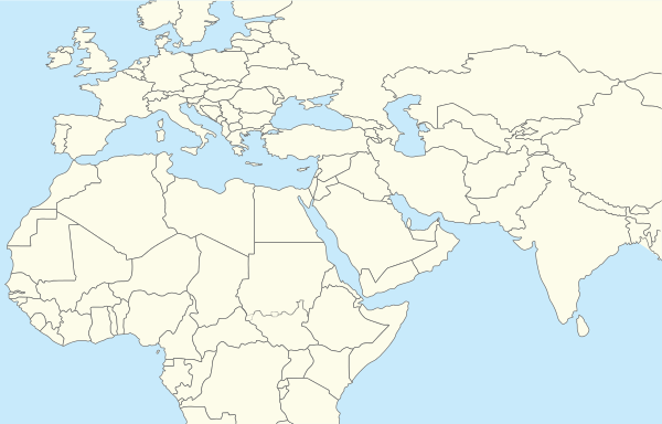
In 1973, Andrew J. Woods, a physicist with Gulf Energy & Environmental Systems in San Diego, used a digital global map and calculated the coordinates on a mainframe system as 39°00′N 34°00′E / 39.000°N 34.000°E, in modern Turkey, 1,000 km north of Giza.[6] In 2003, a similar result was yielded by Holger Isenberg: 40°52'0"N, 34°34'0"E.[7] In 2016, Google Maps marked 40°52′N 34°34′E as the geographic centre of the world. [8]
In 2007, Susan Wise Bauer claimed in her book Earliest Accounts to the Fall of Rome, that the theory that the Great Pyramid was the geographical centre of Earth would only hold true if a Mercator projection is used as the map for Earth, which was "unlikely to have been a common practice of the ancient Egyptians".[9]
See also
References
- ↑ Isenberg, Holger. "Giza, Center of Earth (page 3 of 10)". mars-news.de. Retrieved 27 August 2017.
- ↑ Smyth, Charles Piazzi (1864). Our inheritance in the Great Pyramid. London: W. Isbister & Co. pp. V, 55, 460.
- 1 2 Wilson, Colin; Rand Flem-Ath (2002). The Atlantis Blueprint: Unlocking The Ancient Mysteries Of A Long-Lost Civilization. Random House Digital, Inc. pp. 63–64. Retrieved May 4, 2012.
- ↑ Barnard, Frederick Augustus Porter (1884). The imaginary metrological system of the Great pyramid of Gizeh. John Wiley & Sons. pp. 12–13. Retrieved May 4, 2012.
- ↑ William Galliher (September 1919). "The Riddle of Cheops Pyramid". Trestle Board Magazine. Kessinger Publishing. 33 (3): 9. Retrieved May 4, 2012.
- ↑ Woods, Andrew J. (1973). The Center of the Earth. I.C.R. Technical Monographs. 3. London: I.C.R.
- ↑ Isenberg, Holger. Giza: Centre of Earth, page 5, 2003. http://mars-news.de/pyramids/gizacenter5.html
- ↑ http://www.hurriyetdailynews.com/google-marks-turkeys-corum-as-center-of-the-earth-100514
- ↑ Bauer, Susan Wise (2007). The History of the Ancient World: From the Earliest Accounts to the Fall of Rome. W. W. Norton & Company. p. 86. Retrieved May 4, 2012.
External links
- Huber, W (Jan 17, 2014). "What is Centroid of all lands of Earth?" [Where is the center of continental land area]. Stack Exchange. GIS.