Gehrihorn
| Gehrihorn | |
|---|---|
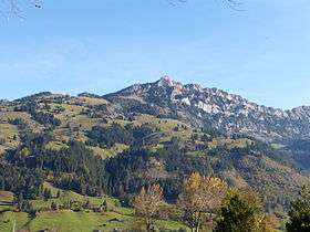 Gehrihorn viewed from the village of Frutigen | |
| Highest point | |
| Elevation | 2,130 m (6,990 ft) |
| Prominence | 40 m (130 ft) [1] |
| Parent peak | Rüederigsgrat (2,142 m) |
| Coordinates | 46°34′25.7″N 7°41′32″E / 46.573806°N 7.69222°ECoordinates: 46°34′25.7″N 7°41′32″E / 46.573806°N 7.69222°E |
| Geography | |
 Gehrihorn Location in Switzerland | |
| Location | Bern, Switzerland |
| Parent range | Bernese Alps |
The Gehrihorn is a mountain of the Bernese Alps, overlooking Frutigen in the Bernese Oberland. It lies at the northern end of the range between the Kandertal and the Kiental.
References
- ↑ Retrieved from the Swisstopo topographic maps and Google Earth. The key col is located south of the summit at 2,090 metres.
External links
This article is issued from
Wikipedia.
The text is licensed under Creative Commons - Attribution - Sharealike.
Additional terms may apply for the media files.