Geestland
| Geestland | |
|---|---|
 Geestland Location of Geestland within Cuxhaven district 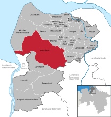  | |
| Coordinates: 53°38′N 8°45′E / 53.633°N 8.750°ECoordinates: 53°38′N 8°45′E / 53.633°N 8.750°E | |
| Country | Germany |
| State | Lower Saxony |
| District | Cuxhaven |
| Area | |
| • Total | 356.20 km2 (137.53 sq mi) |
| Population (2017-12-31)[1] | |
| • Total | 30,873 |
| • Density | 87/km2 (220/sq mi) |
| Time zone | CET/CEST (UTC+1/+2) |
| Postal codes | 27607, 27624 |
| Dialling codes | 04704, 04707, 04708, 0471, 04742, 04743, 04745, 04756, 04765 |
| Vehicle registration | CUX |
Geestland is a town in the district of Cuxhaven, in Lower Saxony, Germany. It was formed on 1 January 2015 by the merger of the former municipalities of Langen bei Bremerhaven, Bad Bederkesa, Drangstedt, Elmlohe, Flögeln, Köhlen, Kührstedt, Lintig and Ringstedt.
References
Towns and municipalities in Cuxhaven (district) | ||
|---|---|---|
This article is issued from
Wikipedia.
The text is licensed under Creative Commons - Attribution - Sharealike.
Additional terms may apply for the media files.