Gedersdorf
| Gedersdorf | ||
|---|---|---|
 | ||
| ||
 Gedersdorf Location within Austria | ||
| Coordinates: 48°26′N 15°41′E / 48.433°N 15.683°ECoordinates: 48°26′N 15°41′E / 48.433°N 15.683°E | ||
| Country | Austria | |
| State | Lower Austria | |
| District | Krems-Land | |
| Government | ||
| • Mayor | Franz Brandl (ÖVP) | |
| Area | ||
| • Total | 18.87 km2 (7.29 sq mi) | |
| Elevation | 194 m (636 ft) | |
| Population (1 January 2016)[1] | ||
| • Total | 2,183 | |
| • Density | 120/km2 (300/sq mi) | |
| Time zone | UTC+1 (CET) | |
| • Summer (DST) | UTC+2 (CEST) | |
| Postal code | 3494 | |
| Area code | 02735 | |
| Website | www.gedersdorf.at | |

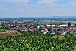
Gedersdorf is a municipality in the district of Krems-Land in the Austrian state of Lower Austria.
Geography
The municipality consists of seven villages: Altweidling, Brunn im Felde, Donaudorf, Gedersdorf, Schlickendorf, Stratzdorf, and Theiß.
History
It was formed in 1967 by the merger of three smaller municipalities.
References
This article is issued from
Wikipedia.
The text is licensed under Creative Commons - Attribution - Sharealike.
Additional terms may apply for the media files.