Gauze Brook
| Gauze Brook | |
| stream | |
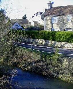 Gauze Brook at Corston | |
| Country | England |
|---|---|
| Region | West of England |
| District | Wiltshire |
| Source | West Dunley Farm |
| - location | Littleton Drew, Wiltshire, England |
| - elevation | 377 ft (115 m) |
| - coordinates | 51°31′35″N 2°14′21″W / 51.5265°N 2.2391°W |
| Mouth | Bristol Avon |
| - location | Little Somerford, Wiltshire, England |
| - elevation | 190 ft (58 m) |
| - coordinates | 51°33′44″N 2°04′49″W / 51.5623°N 2.0802°WCoordinates: 51°33′44″N 2°04′49″W / 51.5623°N 2.0802°W |
| Length | 9.1[1] mi (15 km) |
| River system | Bristol Avon |
The Gauze Brook is a stream in the West Country of England, which rises near the village of Littleton Drew in Wiltshire and flows in a northeasterly direction for approximately 9.1 miles (15 km) before joining the Bristol Avon near the village of Little Somerford.
Course
Gauze Brook rises a little to the north east of the Wiltshire village of Littleton Drew and then flows to the northeast through Dunley Wood before passing to the north of Hullavington. The stream then passes underneath the South Wales main railway line before it arrives at the village of Corston. Just over a mile later it joins the Bristol Avon by Angrove Farm, near Little Somerford.
References
- ↑ "Gauze Brook". Environment Agency - Catchment Data Explorer. Retrieved 1 March 2018.
This article is issued from
Wikipedia.
The text is licensed under Creative Commons - Attribution - Sharealike.
Additional terms may apply for the media files.