Garth railway station (Powys)
| Garth (Powys) | |
|---|---|
_Railway_Station.jpg) | |
| Location | |
| Place | Garth |
| Local authority | Powys |
| Grid reference | SN953494 |
| Operations | |
| Station code | GTH |
| Managed by | Arriva Trains Wales |
| Number of platforms | 1 |
| DfT category | F2 |
|
Live arrivals/departures, station information and onward connections from National Rail Enquiries | |
| Annual rail passenger usage* | |
| 2012/13 |
|
| 2013/14 |
|
| 2014/15 |
|
| 2015/16 |
|
| 2016/17 |
|
| History | |
| Key dates | Opened 1868 |
| National Rail – UK railway stations | |
| * Annual estimated passenger usage based on sales of tickets in stated financial year(s) which end or originate at Garth (Powys) from Office of Rail and Road statistics. Methodology may vary year on year. | |
|
| |
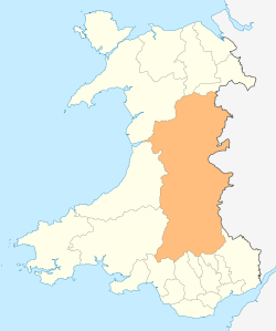
Garth (Powys) railway station serves the village of Garth, Powys, Wales. The railway station is located at street level at the end of the Llais yr Afon lane near the village centre. The station is known as Garth (Powys) in order to differentiate it from Garth (Bridgend).[1]
All trains serving the station are operated by Arriva Trains Wales. There are four trains a day in each direction from Monday to Saturday, and two services on Sundays.[2] This is a request stop, whereby passengers have to signal to the driver to board or alight from the train.
It formerly had a passing loop and two platforms, but only one is now used (the disused one is overgrown but still visible). The facilities provided here are limited to a small brick waiting shelter, timetable poster board, digital CIS display and a customer help point. No ticketing provision is available, so passengers must buy in advance of travel or on board the train.[3]
| Preceding station | Following station | |||
|---|---|---|---|---|
| Llangammarch | Arriva Trains Wales Heart of Wales Line |
Cilmeri | ||
References
- ↑ Arriva Trains Wales. "Garth (Powys)". Retrieved 2013-03-19.
- ↑ GB eNRT May 2017, Table 129 (Network Rail)
- ↑ Garth (Powys) station facilities National Rail Enquiries
Further reading
External links
- Train times and station information for Garth railway station (Powys) from National Rail
Coordinates: 52°07′59″N 3°31′48″W / 52.133°N 3.530°W
