Gari, Tombouctou Region
| Gari | |
|---|---|
| Village | |
 Gari Location in Mali | |
| Coordinates: 16°23′59″N 3°17′59″W / 16.39972°N 3.29972°WCoordinates: 16°23′59″N 3°17′59″W / 16.39972°N 3.29972°W | |
| Country |
|
| Region | Tombouctou Region |
| Cercle | Diré Cercle |
| Commune | Tinguereguif |
| Time zone | UTC+0 (GMT) |
Gari is a village and seat of the commune of Tinguereguif in the Cercle of Diré in the Tombouctou Region of Mali.[1]
References
- ↑ Schéma Directeur de Lutte Contre l’Ensablement dans le Nord du Mali (6ème et 7ème Régions): Monographie de la Commune de Tinguereguif (PDF) (in French), Ministère de l’Environnement et de l’Assainissement, République du Mali, 2004, archived from the original (PDF) on 2011-10-06 .
Capital: Timbuktu | ||
| Diré Cercle | 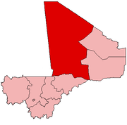 | |
| Goundam Cercle |
| |
| Gourma-Rharous Cercle | ||
| Niafunké Cercle | ||
| Timbuktu Cercle |
| |
This article is issued from
Wikipedia.
The text is licensed under Creative Commons - Attribution - Sharealike.
Additional terms may apply for the media files.