Gargalianoi
| Gargalianoi Γαργαλιάνοι | |
|---|---|
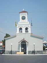 Cathedral in Gargaliani | |
 Gargalianoi Location within the regional unit  | |
| Coordinates: 37°4′N 21°38′E / 37.067°N 21.633°ECoordinates: 37°4′N 21°38′E / 37.067°N 21.633°E | |
| Country | Greece |
| Administrative region | Peloponnese |
| Regional unit | Messenia |
| Municipality | Trifylia |
| • Municipal unit | 122.7 km2 (47.4 sq mi) |
| Elevation | 294 m (965 ft) |
| Population (2011)[1] | |
| • Municipal unit | 7,940 |
| • Municipal unit density | 65/km2 (170/sq mi) |
| Community[1] | |
| • Population | 5,569 (2011) |
| Time zone | UTC+2 (EET) |
| • Summer (DST) | UTC+3 (EEST) |
| Postal code | 244 00 |
| Area code(s) | 27630 |
| Vehicle registration | ΚΜ |
| Website | gargaliani.gr |
Gargalianoi (Greek: Γαργαλιάνοι) is a town and a former municipality in Messenia, Peloponnese, Greece. Since the 2011 local government reform it is part of the municipality Trifylia, of which it is a municipal unit.[2] The municipal unit has an area of 122.680 km2.[3] It is situated 4 km from the Ionian Sea coast, 18 km north of Pylos, 21 km south of Kyparissia and 43 km west of Kalamata. The Greek National Road 9 (Patras - Pyrgos - Pylos) passes through the town.
Subdivisions
The municipal unit Gargalianoi is subdivided into the following communities:
- Floka
- Gargalianoi
- Lefki
- Marathopoli
- Mouzaki
- Pyrgos
- Valta
Famous inhabitants
- Theodore Spiros Agnew, father of United States Vice President Spiro Agnew
- Tellos Agras, Officer of the Hellenic Army during the Greek Struggle for Macedonia
Historical population
| Year | Town population | Municipality population |
|---|---|---|
| 1981 | 5,430 | - |
| 1991 | 5,184 | 7,609 |
| 2001 | 5,970 | 9,083 |
| 2011 | 5,569 | 7,940 |
References
- 1 2 "Απογραφή Πληθυσμού - Κατοικιών 2011. ΜΟΝΙΜΟΣ Πληθυσμός" (in Greek). Hellenic Statistical Authority.
- ↑ Kallikratis law Greece Ministry of Interior (in Greek)
- ↑ "Population & housing census 2001 (incl. area and average elevation)" (PDF) (in Greek). National Statistical Service of Greece. Archived from the original (PDF) on 2015-09-21.
External links
See also
Places adjacent to Gargalianoi | ||||||||||
|---|---|---|---|---|---|---|---|---|---|---|
| ||||||||||
This article is issued from
Wikipedia.
The text is licensed under Creative Commons - Attribution - Sharealike.
Additional terms may apply for the media files.