Garfield Avenue station
Garfield Avenue | |||||||||||
|---|---|---|---|---|---|---|---|---|---|---|---|
| Hudson–Bergen Light Rail station | |||||||||||
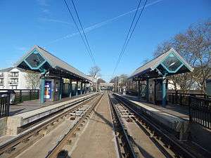 The Garfield Avenue station in April 2015, facing toward West Side Avenue. | |||||||||||
| Location |
Union Street & Carteret Avenue Jersey City, NJ | ||||||||||
| Coordinates | 40°42′38″N 74°04′16″W / 40.7105°N 74.0710°WCoordinates: 40°42′38″N 74°04′16″W / 40.7105°N 74.0710°W | ||||||||||
| Owned by | New Jersey Transit | ||||||||||
| Line(s) | |||||||||||
| Platforms | 2 side platforms | ||||||||||
| Tracks | 2 | ||||||||||
| Construction | |||||||||||
| Disabled access | Yes | ||||||||||
| Other information | |||||||||||
| Fare zone | 1 | ||||||||||
| History | |||||||||||
| Opened | April 22, 2000 | ||||||||||
| Electrified | 750 V (DC) overhead catenary | ||||||||||
| Services | |||||||||||
| |||||||||||
Garfield Avenue is a station on the Hudson–Bergen Light Rail (HBLR)[1] located at Union Street CR 610[2] in the Claremont Section of Jersey City, New Jersey.[3] The station opened on April 22, 2000. It is at the eastern end of a railroad cut originally excavated in Bergen Hill in 1869 for the Central Railroad of New Jersey Newark and New York Railroad Branch. Garfield Avenue, presumably named for assassinated president James A. Garfield, was once part of Bergen Point Plank Road, which itself had once been a major colonial post road. A decorative theme for the station is two dimensional "cut-outs" of adults ad children, some of whom are playing.[4]
Station layout
| Ground/platform level Exit/entrance and elevator | |
| Side platform, doors will open on the right | |
| Southbound | ← West Side–Tonnelle toward West Side Avenue (Martin Luther King Drive) |
| Northbound | West Side–Tonnelle toward Tonnelle Avenue (Liberty State Park) → |
| Side platform, doors will open on the right | |
Vicinity
Gallery
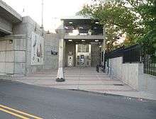 Street-level entrance on the northwest corner of the bridge
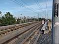 The light rail ROW east of the station (& Randolph Ave Crossing)
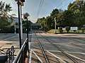 The light rail ROW west of the station
References
- ↑ Garfield Avenue Station details
- ↑ "Hudson County 610 straight line diagram" (PDF). Hudson County Route 610. Archived from the original (PDF) on 2012-10-17. Retrieved 2009-08-18.
- ↑ Hudson County New Jersey Street Map. Hagstrom Map Company, Inc. 2008. ISBN 0-88097-763-9.
- ↑ Garfield Avenue Station photos
External links
This article is issued from
Wikipedia.
The text is licensed under Creative Commons - Attribution - Sharealike.
Additional terms may apply for the media files.