Garafiri Dam
| Garafiri Dam | |
|---|---|
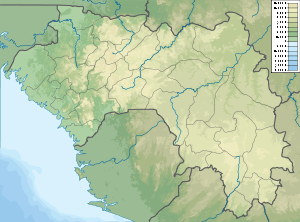 Location of Garafiri Dam in Guinea | |
| Country | Guinea |
| Location | Kindia and Mamou Region |
| Coordinates | 10°31′47.18″N 12°39′45.43″W / 10.5297722°N 12.6626194°WCoordinates: 10°31′47.18″N 12°39′45.43″W / 10.5297722°N 12.6626194°W |
| Purpose | Power |
| Status | Operational |
| Construction began | 1995 |
| Opening date | 1999 |
| Owner(s) | Electricite de Guinee |
| Dam and spillways | |
| Type of dam | Embankment, earth-fill |
| Impounds | Konkouré River |
| Height | 80 m (260 ft) |
| Spillway type | Chute, uncontrolled |
| Reservoir | |
| Total capacity | 1,600×106 m3 (1,300,000 acre⋅ft) |
| Surface area | 61.7 km2 (23.8 sq mi) |
| Commission date | 1999 |
| Turbines | 3 x 25 MW (34,000 hp) Francis-type |
| Installed capacity | 75 MW (101,000 hp) |
The Garafiri Dam is an embankment dam on the Konkouré River which forms the boundary between the Kindia and Mamou Regions of Guinea. The dam was constructed by Salini Impregilo between 1995 and 1999 for the purpose of hydroelectric power generation and water supply. The power station had a breakdown in 2002 but was repaired shortly afterwards. The power station has an installed capacity of 75 megawatts (101,000 hp).[1][2][3]
See also
References
- ↑ "Garafiri dam". Salini Impregilo. Retrieved 25 March 2014.
- ↑ "Hydroelectric Power Plants in West Africa". IndustCards. Archived from the original on 19 July 2009. Retrieved 25 March 2014.
- ↑ "Dams in Africa". UN FAO. Retrieved 25 March 2014.
This article is issued from
Wikipedia.
The text is licensed under Creative Commons - Attribution - Sharealike.
Additional terms may apply for the media files.