Gallaway, Tennessee
| Gallaway, Tennessee | |
|---|---|
| City | |
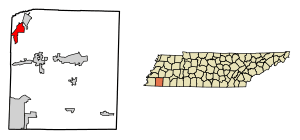 Location of Gallaway in Fayette County, Tennessee. | |
| Coordinates: 35°19′36″N 89°36′59″W / 35.32667°N 89.61639°WCoordinates: 35°19′36″N 89°36′59″W / 35.32667°N 89.61639°W | |
| Country | United States |
| State | Tennessee |
| County | Fayette |
| Area | |
| • Total | 6.1 sq mi (15.9 km2) |
| • Land | 6.1 sq mi (15.9 km2) |
| • Water | 0.0 sq mi (0.0 km2) |
| Elevation | 282 ft (86 m) |
| Population (2010) | |
| • Total | 680 |
| • Estimate (2016)[1] | 657 |
| • Density | 111/sq mi (42.8/km2) |
| Time zone | UTC-6 (Central (CST)) |
| • Summer (DST) | UTC-5 (CDT) |
| ZIP code | 38036 |
| Area code(s) | 901 |
| FIPS code | 47-28560[2] |
| GNIS feature ID | 1285101[3] |
Gallaway is a city in Fayette County, Tennessee, United States. The population was 680 at the 2010 census.[4]
Geography
Gallaway is located in northwestern Fayette County at 35°19′36″N 89°36′59″W / 35.32667°N 89.61639°W (35.326725, -89.616484).[5] U.S. Routes 70 and 79 pass through the northwest side of the city as a single two-lane highway, leading northeast 5 miles (8 km) to Braden and southwest 4 miles (6 km) to Arlington. Downtown Memphis is 30 miles (48 km) to the southwest. Tennessee State Route 196 leads south 6.5 miles (10.5 km) to Hickory Withe.
According to the United States Census Bureau, the city of Gallaway has a total area of 6.1 square miles (15.9 km2), all land.[4] The Loosahatchie River, a tributary of the Mississippi, flows from east to west through the southern part of the city limits.
Demographics
| Historical population | |||
|---|---|---|---|
| Census | Pop. | %± | |
| 1880 | 91 | — | |
| 1890 | 81 | −11.0% | |
| 1900 | 77 | −4.9% | |
| 1970 | 304 | — | |
| 1980 | 804 | 164.5% | |
| 1990 | 762 | −5.2% | |
| 2000 | 666 | −12.6% | |
| 2010 | 680 | 2.1% | |
| Est. 2016 | 657 | [1] | −3.4% |
| Sources:[6][7] | |||
As of the census[2] of 2000, there were 666 people, 235 households, and 145 families residing in the city. The population density was 188.1 people per square mile (72.6/km²). There were 267 housing units at an average density of 75.4 per square mile (29.1/km²). The racial makeup of the city was 39.94% White, 59.01% African American, 0.15% Native American, and 0.90% from two or more races.
There were 235 households out of which 31.5% had children under the age of 18 living with them, 29.8% were married couples living together, 28.9% had a female householder with no husband present, and 37.9% were non-families. 36.2% of all households were made up of individuals and 11.9% had someone living alone who was 65 years of age or older. The average household size was 2.49 and the average family size was 3.26.
In the city, the population was spread out with 28.1% under the age of 18, 9.0% from 18 to 24, 21.5% from 25 to 44, 21.9% from 45 to 64, and 19.5% who were 65 years of age or older. The median age was 38 years. For every 100 females, there were 86.0 males. For every 100 females age 18 and over, there were 76.1 males.
The median income for a household in the city was $15,192, and the median income for a family was $23,750. Males had a median income of $25,179 versus $16,500 for females. The per capita income for the city was $12,836. About 35.5% of families and 43.5% of the population were below the poverty line, including 53.6% of those under age 18 and 15.2% of those age 65 or over.
Commerce
The town's largest employer is Medical Action Industries, a producer of plastic medical supplies and patient bedside items.
References
| Wikimedia Commons has media related to Gallaway, Tennessee. |
- 1 2 "Population and Housing Unit Estimates". Retrieved June 9, 2017.
- 1 2 "American FactFinder". United States Census Bureau. Archived from the original on 2013-09-11. Retrieved 2008-01-31.
- ↑ "US Board on Geographic Names". United States Geological Survey. 2007-10-25. Retrieved 2008-01-31.
- 1 2 "Geographic Identifiers: 2010 Demographic Profile Data (G001): Gallaway city, Tennessee". U.S. Census Bureau, American Factfinder. Retrieved August 16, 2016.
- ↑ "US Gazetteer files: 2010, 2000, and 1990". United States Census Bureau. 2011-02-12. Retrieved 2011-04-23.
- ↑ "Census of Population and Housing: Decennial Censuses". United States Census Bureau. Archived from the original on 2006-02-08. Retrieved 2012-03-04.
- ↑ "Incorporated Places and Minor Civil Divisions Datasets: Subcounty Resident Population Estimates: April 1, 2010 to July 1, 2012". Population Estimates. U.S. Census Bureau. Archived from the original on 17 June 2013. Retrieved 11 December 2013.
Municipalities and communities of Fayette County, Tennessee, United States | ||
|---|---|---|
| Cities | ||
| Towns | ||
| Unincorporated communities | ||
| Footnotes | ‡This populated place also has portions in an adjacent county or counties | |