Galchutt, North Dakota
| Galchutt, North Dakota | |
|---|---|
| Unincorporated community | |
 Looking north at Galchutt | |
 Galchutt, North Dakota  Galchutt, North Dakota | |
| Coordinates: 46°23′15″N 96°48′34″W / 46.38750°N 96.80944°WCoordinates: 46°23′15″N 96°48′34″W / 46.38750°N 96.80944°W | |
| Country | United States |
| State | North Dakota |
| County | Richland |
| Elevation | 951 ft (290 m) |
| Time zone | UTC-6 (Central (CST)) |
| • Summer (DST) | UTC-5 (CDT) |
| Area code(s) | 701 |
| GNIS feature ID | 1029073[1] |
Galchutt is an unincorporated community in Richland County, North Dakota, United States. Galchutt is located along the Red River Valley and Western Railroad 12.9 miles (20.8 km) northwest of Wahpeton.[2]
References
- ↑ "Galchutt". Geographic Names Information System. United States Geological Survey.
- ↑ Richland County, North Dakota General Highway Map (PDF) (Map). North Dakota Department of Transportation. 2008. p. 1. Retrieved July 13, 2012.
External links
Municipalities and communities of Richland County, North Dakota, United States | ||
|---|---|---|
| Cities | 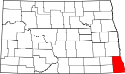 | |
| Townships | ||
| Unincorporated communities | ||
| Indian reservations | ||
| Footnotes | ‡This populated place also has portions in an adjacent county or counties | |
This article is issued from
Wikipedia.
The text is licensed under Creative Commons - Attribution - Sharealike.
Additional terms may apply for the media files.