Głogoczów
| Głogoczów | |
|---|---|
| Village | |
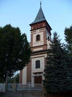 Saint Mary Magdalene Church | |
 Głogoczów | |
| Coordinates: 49°53′49″N 19°52′33″E / 49.89694°N 19.87583°E | |
| Country |
|
| Voivodeship | Lesser Poland |
| County | Myślenice |
| Gmina | Myślenice |
| Highest elevation | 340 m (1,120 ft) |
| Lowest elevation | 250 m (820 ft) |
| Population | 2,800 |
Głogoczów [ɡwɔˈɡɔt͡ʂuf] is a village in the administrative district of Gmina Myślenice, within Myślenice County, Lesser Poland Voivodeship, in southern Poland. It lies approximately 9 kilometres (6 mi) north-west of Myślenice and 19 km (12 mi) south of the regional capital Kraków.[1]
The village has a population of 2,800.
References
External links
- http://glogoczow.malopolska.pl/ Wiejski Dom Kultury w Głogoczowie
- http://wies-jak-dzwon.pl/ Promocja Wsi Tematycznej Głogoczów
- http://www.glogoczow.pl/ Aktualności z życia Głogoczowa
| Town and seat |  | |
|---|---|---|
| Villages | ||
Coordinates: 49°53′49″N 19°52′33″E / 49.89694°N 19.87583°E
This article is issued from
Wikipedia.
The text is licensed under Creative Commons - Attribution - Sharealike.
Additional terms may apply for the media files.