Furus
| Furus فروس Furoos, Phuroos | |
|---|---|
| village | |
 | |
 Furus Location in Maharashtra, India  Furus Furus (India) | |
| Coordinates: 17°42′N 73°21′E / 17.70°N 73.35°ECoordinates: 17°42′N 73°21′E / 17.70°N 73.35°E | |
| Country |
|
| State | Maharashtra |
| District | Ratnagiri |
| Government | |
| • Body | Gram Panchayat |
| • Sarpanch | Mr Laksuman Navrat |
| Population (2010) | |
| • Total | 5,600 |
| Languages | |
| • Official | Konkani, Marathi, Urdu, Hindi, English |
| Time zone | UTC+5:30 (IST) |
| PIN | 415710 |
| Telephone code | 02356 |
| Literacy | 85% |
| Climate | humid (Köppen) |
| Website |
www |
Furus (Marathi: फुरूस) is a village in Ratnagiri district, Maharashtra state in Western India.[1] The 2011 Census of India recorded a total of 1,129 residents in the village.[2] Furus's geographical area is approximately 905 hectares (2,240 acres).[2] It is mainly populated by Konkani Muslims. Furus is believed to be named by Persians who came here to trade in horses (horse: فارسی Persian). The main language spoken in Furus is Kokni (not to be confused with Goan Konkani), a blend of Bankoti, Sangameshwari and Marathi infused with words of Arabic, Urdu and Persian origin.
Furus Amshet is a small village in the same region.[2] The 2011 Census of India recorded a total of 577 residents in the village.[2] Furus Amshet's geographical area is approximately 73 hectares (180 acres).[2]
Furus Gaonthan is a small village in the same region.[2] The 2011 Census of India recorded a total of 438 residents in the village.[2] Furus Amshet's geographical area is 33 hectares (82 acres).[2]
History
Kokni Muslims trace their ancestry back to the Arab traders who arrived on the Western coast of India during the medieval era and Persians. Muslims first arrived in Konkan in 699, according to Jalal al-Din al-Suyuti, less than 70 years after the death of Muhammad in 632.[3]
Location
Furus is on State Highway SH104 between Khed and Dapoli.[4] The nearest Railway Station is Khed which is 12 km away. 14 km. from Dapoli. Furus is situated beside the banks of a nameless petite tributary and is surrounded on all sides by low hills. It rains in plenty during Monsoon season. The temperature in Furus varies between 20 and 35 degrees. Ratnagiri District can be physically divided into 3 zones viz. Coastal, Middle and Hilly. Furus falls under Middle Zone. Middle zone is characterized by a medium altitude. It is more accessible due to the Bombay–Goa Highway as well as the Konkan railway.
Transportation
Furus is well-connected by road to nearby big towns. State Highway 104, Khed to Dapoli passes from Furus. Besides auto-rickshaw are available round-the clock.
Educational facilities

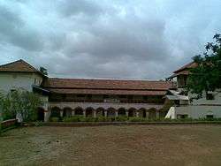
Furus was one of the first townships in the area to have a high school. S.I. High School & Junior College of Science, Furus was founded by "Adv. & ex MLA W. A. Parkar" under a government initiative in 1938 (pre-independence time). The School was in English Medium named Anglo Vernacular High School and is still functional.
Community
Furus consists of 7 sub-villages and over 1200 homes with a population of nearly 5600. The main religions here are Islam, Hinduism and Buddhism. The Muslim community consists of 7 Sub Jamaats also called as Mohallas. They are
- Navanagar (नवानगर) mohalla
- Choughan (चौगन) mohalla
- Fanaswad (फणसवाड)
- Tahtani (तहतानी) mohalla
- Tekdi (टेकडी) mohalla and
- Aathvi (आठवी) mohalla
- Falsonda (फल्सोंडा)
See also
References
- ↑ Rural Housing Report for Financial year 2010-2011
- 1 2 3 4 5 6 7 8 "District Census Handbook" (PDF). Census of India. p. 96. Retrieved 16 April 2016.
- ↑ Parkar migrated from Furus of Jaoli taluka Satara district
- ↑
- General