Freigné
| Freigné | ||
|---|---|---|
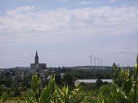 A general view of Freigné | ||
| ||
 Freigné Location within Pays de la Loire region  Freigné | ||
| Coordinates: 47°32′57″N 1°07′16″W / 47.5492°N 1.1211°WCoordinates: 47°32′57″N 1°07′16″W / 47.5492°N 1.1211°W | ||
| Country | France | |
| Region | Pays de la Loire | |
| Department | Loire-Atlantique | |
| Arrondissement | Châteaubriant-Ancenis | |
| Canton | Ancenis | |
| Area1 | 65.26 km2 (25.20 sq mi) | |
| Population (2006[1])2 | 1,119 | |
| • Density | 17/km2 (44/sq mi) | |
| Demonym(s) | Freignéen, Freignéenne | |
| Time zone | UTC+1 (CET) | |
| • Summer (DST) | UTC+2 (CEST) | |
| INSEE/Postal code | 44225 /49440 | |
| Elevation |
27–85 m (89–279 ft) (avg. 52 m or 171 ft) | |
|
1 French Land Register data, which excludes lakes, ponds, glaciers > 1 km2 (0.386 sq mi or 247 acres) and river estuaries. 2 Population without double counting: residents of multiple communes (e.g., students and military personnel) only counted once. | ||
.svg.png)
Freigné is a former commune in the Loire-Atlantique department in western France. Before 1 January 2018, it was part of the Maine-et-Loire department.[2] On 1 January 2018, it was merged into the new commune of Vallons-de-l'Erdre.[3]
References
- ↑ populations légales 2006 sur le site de l’INSEE
- ↑ Décret n° 2017-1757 26 December 2017 (in French)
- ↑ Arrêté préfectoral 29 December 2017 (in French)
| Wikimedia Commons has media related to Freigné. |
This article is issued from
Wikipedia.
The text is licensed under Creative Commons - Attribution - Sharealike.
Additional terms may apply for the media files.