Fostoria, Michigan
| Fostoria, Michigan | |
|---|---|
| Census-designated place | |
 Fostoria, Michigan  Fostoria, Michigan | |
| Coordinates: 43°15′12″N 83°22′19″W / 43.25333°N 83.37194°WCoordinates: 43°15′12″N 83°22′19″W / 43.25333°N 83.37194°W | |
| Country | United States |
| State | Michigan |
| County | Tuscola |
| Area[1] | |
| • Total | 3.861 sq mi (10.00 km2) |
| • Land | 3.860 sq mi (10.00 km2) |
| • Water | 0.001 sq mi (0.003 km2) |
| Elevation | 853 ft (260 m) |
| Population (2010)[1] | |
| • Total | 694 |
| • Density | 180/sq mi (69/km2) |
| Time zone | UTC-5 (Eastern (EST)) |
| • Summer (DST) | UTC-4 (EDT) |
| ZIP code | 48435 |
| Area code(s) | 810 |
| GNIS feature ID | 626321[2] |
Fostoria is an unincorporated community and census-designated place in Watertown Township, Tuscola County, Michigan, United States. Its population was 694 as of the 2010 census.[1] Fostoria has a post office with ZIP code 48435.[3][4]
Geography
According to the U.S. Census Bureau, the community has an area of 3.861 square miles (10.00 km2), of which 3.860 square miles (10.00 km2) is land and 0.001 square miles (0.0026 km2) is water.[1]
History
Michigan Governor Henry H. Crapo once owned most of the pine forestland in the area and had a line of the Pere Marquette Railway run through Fostoria. The community was named for Crapo's foreman, Thomas Foster, in 1881. Its first post office operated from July 1882 until May 1883.[5]
References
- 1 2 3 4 "2010 Census Gazetteer Files - Places: Michigan". U.S. Census Bureau. Retrieved May 5, 2018.
- ↑ "Fostoria". Geographic Names Information System. United States Geological Survey.
- ↑ United States Postal Service. "USPS - Look Up a ZIP Code". Retrieved May 6, 2018.
- ↑ "Postmaster Finder - Post Offices by ZIP Code". United States Postal Service. Retrieved May 6, 2018.
- ↑ Romig, Walter (1986) [1973]. Michigan Place Names. Detroit, Michigan: Wayne State University Press. ISBN 0-8143-1838-X.
Municipalities and communities of Tuscola County, Michigan, United States | ||
|---|---|---|
| Cities | 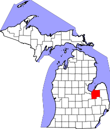 | |
| Villages | ||
| Charter township | ||
| General law townships | ||
| CDP | ||
| Other unincorporated communities | ||
| Footnotes | ‡This populated place also has portions in an adjacent county or counties | |
This article is issued from
Wikipedia.
The text is licensed under Creative Commons - Attribution - Sharealike.
Additional terms may apply for the media files.