Formoso do Araguaia
| Formoso do Araguaia | ||
|---|---|---|
| Municipality | ||
| The Municipality of Formoso do Araguaia | ||
 A lake in Formoso do Araguaia | ||
| ||
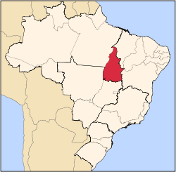
 Location of Formoso do Araguaia in the state of Tocantins | ||
 Formoso do Araguaia Location of Formoso do Araguaia in Brazil | ||
| Coordinates: 11°48′09″S 49°31′42″W / 11.80250°S 49.52833°WCoordinates: 11°48′09″S 49°31′42″W / 11.80250°S 49.52833°W | ||
| Country |
| |
| Region | North | |
| State |
| |
| Founded | October 1, 1963 | |
| Government | ||
| • Mayor | Pedro Rezende (PTB) | |
| Area | ||
| • Total | 13,423.256 km2 (5,182.748 sq mi) | |
| Elevation | 240 m (790 ft) | |
| Population (2012) | ||
| • Total | 18,369 | |
| • Density | 1.4/km2 (3.5/sq mi) | |
| [1] | ||
| Time zone | UTC-3 (UTC-3) | |
| • Summer (DST) | UTC-2 (UTC-2) | |
| HDI (2000) | 0.710 – medium[2] | |

Formoso do Araguaia is a municipality in the state of Tocantins in the Northern region of Brazil.[3][4] It is the largest municipality by area in that state.
See also
References
- ↑ "2012 Populational Estimate" (PDF). Censo Populacional 2012. Instituto Brasileiro de Geografia e Estatística (IBGE). July 2012. Retrieved September 10, 2012.
- ↑ "Archived copy". Archived from the original on 2009-10-03. Retrieved 2009-12-17. - UNDP
- ↑ "Divisão Territorial do Brasil" (in Portuguese). Divisão Territorial do Brasil e Limites Territoriais, Instituto Brasileiro de Geografia e Estatística (IBGE). July 1, 2008. Retrieved December 17, 2009.
- ↑ "Produto Interno Bruto dos Municípios 2002-2005" (PDF) (in Portuguese). Instituto Brasileiro de Geografia e Estatística (IBGE). December 19, 2007. Archived from the original (PDF) on October 2, 2008. Retrieved December 17, 2009.
This article is issued from
Wikipedia.
The text is licensed under Creative Commons - Attribution - Sharealike.
Additional terms may apply for the media files.