Foot of Ten, Pennsylvania
| Foot of Ten, Pennsylvania | |
|---|---|
| Census-designated place | |
 Foot of Ten Location within the state of Pennsylvania | |
| Coordinates: 40°24′57″N 78°27′19″W / 40.41583°N 78.45528°WCoordinates: 40°24′57″N 78°27′19″W / 40.41583°N 78.45528°W | |
| Country | United States |
| State | Pennsylvania |
| County | Blair |
| Townships | Allegheny, Juniata |
| Elevation | 1,106 ft (337 m) |
| Population (2010) | |
| • Total | 672 |
| Time zone | UTC-5 (Eastern (EST)) |
| • Summer (DST) | UTC-4 (EDT) |
| GNIS feature ID | 1174942[1] |
Foot of Ten is a census-designated place[2] in Allegheny and Juniata Townships in Blair County, Pennsylvania. It is located about a mile west of the small borough Duncansville on Foot of Ten Road, and about 2.5 miles north of the even smaller borough Newry. As of the 2010 census, the population was 672 residents.[3]
The town was named Foot of Ten because of its location at the foot of the tenth inclined plane of the Allegheny Portage Railroad.[4][5]
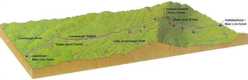 Profile of the original line of the portage railroad from Hollidaysburg, PA to Johnstown, PA. Foot of Ten lies just east of the inclined plane labeled 10.
See also
- Puzzletown, Pennsylvania a nearby unincorporated place on Puzzletown Road.
References
- ↑ U.S. Geological Survey Geographic Names Information System: Foot of Ten, Pennsylvania
- ↑ "Archived copy". Archived from the original on December 21, 2013. Retrieved February 10, 2013.
- ↑ Bureau, US Census. "Census.gov". www.census.gov. Retrieved 2016-07-23.
- ↑ "Allegheny Portage Railroad". History & Culture. National Park Service. Retrieved November 15, 2016.
- ↑ "Funny Name". Foot of Ten Independent Baptist Church. Retrieved November 15, 2016.
Municipalities and communities of Blair County, Pennsylvania, United States | ||
|---|---|---|
| City | 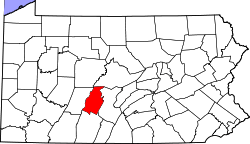 | |
| Boroughs | ||
| Townships | ||
| CDPs | ||
| Unincorporated communities | ||
| Footnotes | ‡This populated place also has portions in an adjacent county or counties | |
This article is issued from
Wikipedia.
The text is licensed under Creative Commons - Attribution - Sharealike.
Additional terms may apply for the media files.