Floral City Historic District
|
Floral City Historic District | |
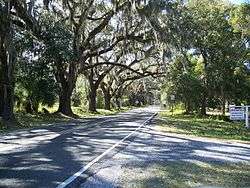 Eastern entrance to the district, on Orange Avenue | |
  | |
| Location | Floral City, Florida |
|---|---|
| Coordinates | 28°45′2″N 82°17′27″W / 28.75056°N 82.29083°WCoordinates: 28°45′2″N 82°17′27″W / 28.75056°N 82.29083°W |
| Area | 20 acres (81,000 m2) |
| NRHP reference # | 93001357[1] |
| Added to NRHP | December 1, 1993 |
| Wikimedia Commons has media related to: |
The Floral City Historic District is a U.S. Historic District (designated as such on December 1, 1993) located in Floral City, Florida. The district runs roughly along Orange Avenue from South Old Floral City Road to South Annie Terrace and South Aroostook Way from Orange to Tsala Apopka Lake. It contains 26 historic buildings and 2 structures.[1]
References
- 1 2 National Park Service (2010-07-09). "National Register Information System". National Register of Historic Places. National Park Service.


This article is issued from
Wikipedia.
The text is licensed under Creative Commons - Attribution - Sharealike.
Additional terms may apply for the media files.