Fleetwood, North Carolina
| Fleetwood, North Carolina | |
|---|---|
| Unincorporated community | |
 Fleetwood, North Carolina  Fleetwood, North Carolina | |
| Coordinates: 36°18′22″N 81°30′48″W / 36.30611°N 81.51333°WCoordinates: 36°18′22″N 81°30′48″W / 36.30611°N 81.51333°W | |
| Country | United States |
| State | North Carolina |
| County | Ashe |
| Elevation | 2,874 ft (876 m) |
| Time zone | UTC-5 (Eastern (EST)) |
| • Summer (DST) | UTC-4 (EDT) |
| ZIP code | 28626 |
| Area code(s) | 336 |
| GNIS feature ID | 985205[1] |
Fleetwood is an unincorporated community in Ashe County, North Carolina, United States. Fleetwood is located along Railroad Grade Road near U.S. Route 221, 8.2 miles (13.2 km) south-southwest of Jefferson. Fleetwood has a post office with ZIP code 28626, which opened on July 27, 1898.[2][3]
References
- ↑ "Fleetwood". Geographic Names Information System. United States Geological Survey.
- ↑ United States Postal Service (2012). "USPS - Look Up a ZIP Code". Retrieved 2012-02-15.
- ↑ "Postmaster Finder - Post Offices by ZIP Code". United States Postal Service. Retrieved March 6, 2014.
Municipalities and communities of Ashe County, North Carolina, United States | ||
|---|---|---|
| Towns | 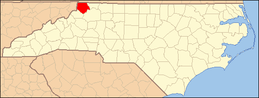 | |
| Unincorporated communities | ||
This article is issued from
Wikipedia.
The text is licensed under Creative Commons - Attribution - Sharealike.
Additional terms may apply for the media files.