Finsterwolde
| Finsterwolde | |
|---|---|
| Village | |
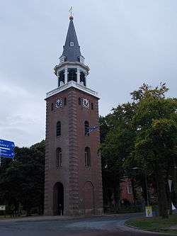 Bell tower of the Protestant Church in 2012 | |
 Finsterwolde Location of Finsterwolde in the province of Groningen | |
| Coordinates: 53°11′53″N 7°5′1″E / 53.19806°N 7.08361°E | |
| Country | Netherlands |
| Province | Groningen |
| Municipality | Oldambt |
| Area | |
| • Total | 42.16 km2 (16.28 sq mi) |
| Population (2011) | 2,515 [1] |
Finsterwolde (Dutch pronunciation: [ˌfɪnstərˈʋɔldə]) is a village in the Dutch province of Groningen, about 7 km northeast of the city of Winschoten. Finsterwolde was a separate municipality until 1990, when it was merged with Beerta into Reiderland.[2] In 2010 Reiderland merged into the municipality Oldambt. The old municipality of Finsterwolde included six small nearby or connecting settlements. These are also taken into account in the population estimate of 2008, without which the actual population, purely based on the centre and new developments, would be 1250.[1]
History
The town was named 'Little Moscow' by TIME magazine in 1950, because communists have always had the majority of the votes since 1933.[3] In July 1951, the elected municipality council was replaced by a regeringscommissaris, who ruled Finsterwolde until September 1953.[4]
Born in Finsterwolde
Arie Haan (1948), Dutch footballer and coach
References
- 1 2 Centraal Bureau voor de Statistiek (CBS) (2011). "Gemeente Op Maat - Oldambt" (PDF): 51. Archived from the original (PDF) on 18 October 2014. Retrieved 18 May 2013.
- ↑ Ad van der Meer and Onno Boonstra, "Repertorium van Nederlandse gemeenten", KNAW, 2006. "Archived copy". Archived from the original on 2007-02-20. Retrieved 2009-12-03.
- ↑ http://content.time.com/time/magazine/article/0,9171,813964,00.html
- ↑ Wio Joustra (1997). "Groningse gemeente Reiderland verzet zich tegen financiële betutteling door Den Haag; 'Armste gemeente betaalt hoogste belasting'". de Volkskrant. Retrieved 8 August 2014. : "de laatste regeringscommissaris in Finsterwolde, dat was begin jaren vijftig, van juli 1951 tot september 1953 om precies te zijn."
External links
- Map of the former municipality in 1868

Coordinates: 53°12′N 7°05′E / 53.200°N 7.083°E