Fils (river)
| Fils | |
|---|---|
 | |
| Country | Germany |
| Physical characteristics | |
| Main source | Swabian Alb |
| River mouth |
Neckar 48°42′23″N 9°25′13″E / 48.70639°N 9.42028°ECoordinates: 48°42′23″N 9°25′13″E / 48.70639°N 9.42028°E |
| Length | 62.9 km (39.1 mi) [1] |
| Basin features | |
| Progression | Neckar→ Rhine→ North Sea |
| Basin size | 699 km2 (270 sq mi) [1] |
| Tributaries | |
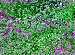
The Fils is a 63 km long river in Baden-Württemberg, Germany, a right tributary of the Neckar.
Its source is in the Swabian Alb hills near Wiesensteig. It flows through Geislingen (Steige) and Göppingen to join the Neckar in Plochingen, east of Stuttgart. Due to the contribution of the Fils, the Neckar is navigable from there.
References
This article is issued from
Wikipedia.
The text is licensed under Creative Commons - Attribution - Sharealike.
Additional terms may apply for the media files.