Faulkner Nunatak
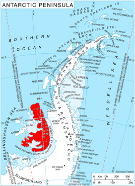
Location of Alexander Island in the Antarctic Peninsula region
Faulkner Nunatak (69°36′S 71°42′W / 69.600°S 71.700°WCoordinates: 69°36′S 71°42′W / 69.600°S 71.700°W) is a distinctive nunatak, about 200 metres (660 ft) high, just west of Beagle Peak and 9.5 km west by south of Mount Devol in the Lassus Mountains, in the northwest part of Alexander Island, Antarctica. The feature appears in U.S. Navy aerial photographs obtained in 1966. It was named by the Advisory Committee on Antarctic Names after Harold T. Faulkner, U.S. Navy, Leading Chief of Squadron VXE-6 Photo Division on Operation Deep Freeze, 1969.[1]
See also
References
- ↑ "Faulkner Nunatak". Geographic Names Information System. United States Geological Survey. Retrieved 2012-03-16.
![]()
This article is issued from
Wikipedia.
The text is licensed under Creative Commons - Attribution - Sharealike.
Additional terms may apply for the media files.