Falerii Novi
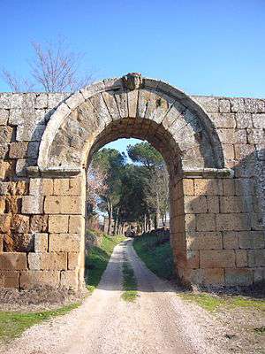
Falerii Novi was a walled town in the Tiber River valley, about 50 km north of Rome and 6 km west of Civita Castellana. It was created by the Romans, who resettled the inhabitants of Falerii Veteres in this much less defensible position after a revolt in 241 BC. The town is situated on a slight volcanic plateau.
Recently, the town has been surveyed as part of the Tiber Valley Project, showing the urbanisation of this area by the Romans. The plan produced by the British School at Rome using magnetometry reveals in great detail the subsurface archaeological features of the Republican city.[1]
History
Falerii Novi is believed to have been founded when the Roman's replaced one of the Falisci tribes following a revolt against Roman authority in around 241 BC. The site was significantly less defensible than the original Falerii Veteres from where the tribe was moved. During the 3rd and 4th centuries BC, the town was home to around 2,500 inhabitants.[2]
Notable structures
The Church of Santa Maria de Falerii
The church of S. Maria of Falerii is the most visible location left among the ruins.
Falerii Temple
The site also contains the remnants of a large Roman temple which predates the settlement measuring roughly 120 meters long by 60 meters wide. The foundations of this temple were discovered by ground penetrating radar placing it several feet underneath the current excavations.[2]
References
- ↑ Keay, Simon; Millett, M.; Poppy, S.; Robinson, J.; Taylor, J.; Terrenato, N. (2000). "Falerii Novi: a New Survey of the Walled Area". Papers of the British School at Rome. 68: 1–93.
- 1 2 Keating, Fiona (March 18, 2017). "Ancient Roman temple the size of St Paul's Cathedral discovered in Italy". ibtimes.co.uk. International Business Times. Retrieved March 20, 2017.
Bibliography
- S. Keay, M. Millett, S. Poppy, J. Robinson, J. Taylor, N. Terrenato, “Falerii Novi: a New Survey of the Walled Area”, Papers of the British School at Rome 68 (2000) 1-93.
- Harris, W., R. Talbert, T. Elliott, S. Gillies. "Places: 413125 (Falerii)". Pleiades. Retrieved March 9, 2012.
External links
Coordinates: 42°18′00″N 12°21′32″E / 42.299900°N 12.358876°E