Fairdealing, Missouri
| Fairdealing, Missouri | |
|---|---|
| Census-designated place & unincorporated community | |
 Fairdealing Location of Fairdealing within the state of Missouri | |
| Coordinates: 36°39′46″N 90°37′00″W / 36.66278°N 90.61667°WCoordinates: 36°39′46″N 90°37′00″W / 36.66278°N 90.61667°W[1] | |
| Country | United States |
| State | Missouri |
| County | Ripley |
| Area | |
| • Total | 5.75 sq mi (14.88 km2) |
| • Land | 5.73 sq mi (14.85 km2) |
| • Water | 0.008 sq mi (0.02 km2) |
| Elevation[1] | 459 ft (140 m) |
| Population (2010) | |
| • Total | 676 |
| • Density | 118/sq mi (45.5/km2) |
Fairdealing is an unincorporated community and census-designated place located in northeastern Ripley County in southeastern Missouri, United States. As of the 2010 census, the community had a population of 676.[2] It is located along U.S. Route 160, about 16 miles (26 km) southwest of Poplar Bluff.[3]
A post office has been in operation at Fairdealing since 1883.[4] Several traditions attempt to explain the name.[5]
References
- 1 2 U.S. Geological Survey Geographic Names Information System: Fairdealing, Missouri
- ↑ "Geographic Identifiers: 2010 Demographic Profile Data (G001): Fairdealing CDP, Missouri". U.S. Census Bureau, American Factfinder. Retrieved January 23, 2014.
- ↑ Fairdealing, Missouri, 7.5 Minute Topographic Quadrangle, USGS, 1979 (1986rev.)
- ↑ "Post Offices". Jim Forte Postal History. Retrieved 14 December 2016.
- ↑ "Ripley County Place Names, 1928–1945". The State Historical Society of Missouri. Archived from the original on June 24, 2016. Retrieved December 14, 2016.
Municipalities and communities of Ripley County, Missouri, United States | ||
|---|---|---|
| Cities | 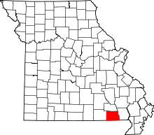 | |
| Townships | ||
| CDPs | ||
| Other unincorporated communities | ||
| Ghost towns | ||
| Footnotes | ‡This populated place also has portions in an adjacent county or counties | |
This article is issued from
Wikipedia.
The text is licensed under Creative Commons - Attribution - Sharealike.
Additional terms may apply for the media files.