Eyrewell Forest
| Eyrewell Forest | |
|---|---|
| Rural Area | |
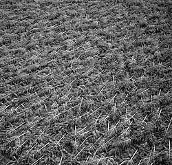 Destruction of the forest the area is named after on 1 August 1975 | |
 Eyrewell Forest | |
| Coordinates: 43°25′S 172°19′E / 43.42°S 172.31°ECoordinates: 43°25′S 172°19′E / 43.42°S 172.31°E | |
| Country |
|
| Region | Canterbury |
| Territorial authority | Waimakariri District |
| Electorates |
Waimakariri Te Tai Tonga (Maori electorate)[1] |
| Time zone | UTC+12 (NZST) |
| • Summer (DST) | UTC+13 (NZDT) |
| Postcode | 7476 and 7495 |
| Area code(s) | 03 |
| Local iwi | Ngāi Tahu |
Eyrewell Forest is a small rural area in the Waimakariri District, New Zealand. About half of the area is forestland, which the area's name is derived from.
History
Due to Canterbury's lack of native forest, in the early 1900s the government planted exotic forests throughout North Canterbury, including Eyrewell Forest. On 1 August 1975, however, most of the forest was blown over by strong north-westerly winds.
Climate
The average temperature in summer is 16.2 °C, and in winter is 5.9 °C.[2]
| Month | Normal temperature |
|---|---|
| January | 16.8 °C |
| February | 16.3 °C |
| March | 14.6 °C |
| April | 11.6 °C |
| May | 8.3 °C |
| June | 5.8 °C |
| July | 5.3 °C |
| August | 6.5 °C |
| September | 8.9 °C |
| October | 11.2 °C |
| November | 13.3 °C |
| December | 15.5 °C |
References
- ↑ http://www.elections.org.nz/mapping/
- ↑ "Weather statistics for EYREWELL FOREST, Canterbury (New Zealand)". yr.no. Retrieved 28 November 2013.
This article is issued from
Wikipedia.
The text is licensed under Creative Commons - Attribution - Sharealike.
Additional terms may apply for the media files.