Evangeline, Louisiana
| Evangeline, Louisiana | |
|---|---|
| Unincorporated community | |
 Evangeline, Louisiana  Evangeline, Louisiana | |
| Coordinates: 30°15′45″N 92°34′14″W / 30.26250°N 92.57056°WCoordinates: 30°15′45″N 92°34′14″W / 30.26250°N 92.57056°W | |
| Country | United States |
| State | Louisiana |
| Parish | Acadia |
| Elevation | 30 ft (9 m) |
| Time zone | UTC-6 (Central (CST)) |
| • Summer (DST) | UTC-5 (CDT) |
| ZIP code | 70537 |
| Area code(s) | 337 |
| GNIS feature ID | 543191[1] |
Evangeline is an unincorporated community in Acadia Parish, Louisiana, United States. The community is located at the junction of Louisiana highways 97 and 100, 5.9 miles (9.5 km) east-northeast of Jennings. Evangeline has a post office with ZIP code 70537.[2][3]
References
- ↑ "Evangeline". Geographic Names Information System. United States Geological Survey.
- ↑ United States Postal Service. "USPS - Look Up a ZIP Code". Retrieved February 19, 2015.
- ↑ "Postmaster Finder - Post Offices by ZIP Code". United States Postal Service. Retrieved February 19, 2015.
Municipalities and communities of Acadia Parish, Louisiana, United States | ||
|---|---|---|
| Cities | 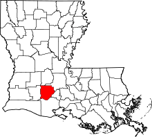 | |
| Towns | ||
| Villages | ||
| CDPs | ||
| Other unincorporated communities |
| |
| Footnotes | ‡This populated place also has portions in an adjacent parish or parishes | |
This article is issued from
Wikipedia.
The text is licensed under Creative Commons - Attribution - Sharealike.
Additional terms may apply for the media files.