Etalin
| Etalin | |
|---|---|
| Village | |
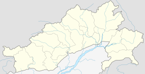 Etalin Location of Anini in India.  Etalin Etalin (India) | |
| Coordinates: 28°36′29″N 95°52′19″E / 28.608°N 95.87205°ECoordinates: 28°36′29″N 95°52′19″E / 28.608°N 95.87205°E | |
| Country |
|
| State | Arunachal Pradesh |
| District | Dibang Valley |
| Elevation | 1,968 m (6,457 ft) |
| Population (2001) | |
| • Total | 314[1] |
| Time zone | UTC+5:30 (Indian Standard Time) |
| ISO 3166 code | IN-AR |
Etalin is a small village in the Dibang Valley district. It is located in the Indian state of Arunachal Pradesh It is a rest stop used by those taking the route to Anini or Malinye. Etalin is approximately 52 KM from Anini and approximately 42 KM from Malinye. The nearest hospital is the Anini General Hospital.There is one middle school in etalin and for further study they have to move to Anini High secondary School or Roing High Secondary School, the nearest airport is in Assam (Mohanbari)
Sources
This article is issued from
Wikipedia.
The text is licensed under Creative Commons - Attribution - Sharealike.
Additional terms may apply for the media files.