Ertl, Lower Austria
| Ertl | ||
|---|---|---|
| ||
 Ertl Location within Austria | ||
| Coordinates: 47°59′N 14°38′E / 47.983°N 14.633°ECoordinates: 47°59′N 14°38′E / 47.983°N 14.633°E | ||
| Country | Austria | |
| State | Lower Austria | |
| District | Amstetten | |
| Government | ||
| • Mayor | Alois Panstingl-Panstingl | |
| Area | ||
| • Total | 21.11 km2 (8.15 sq mi) | |
| Elevation | 440 m (1,440 ft) | |
| Population (1 January 2016)[1] | ||
| • Total | 1,263 | |
| • Density | 60/km2 (150/sq mi) | |
| Time zone | UTC+1 (CET) | |
| • Summer (DST) | UTC+2 (CEST) | |
| Postal code | 3355 | |
| Area code | 07477 | |
| Website | www.ertl.gv.at | |

Ertl is a town in the district of Amstetten in Lower in Austria.
History
In ancient times, the area that is now Ertl was part of the province of Noricum.
The territory was inhabited in the Middle Neolithic period (c. 2500 BC), as evidenced by the discovery of some stone axes, tools, and other artifacts of the period.[2]
The present town was formed in 1922, from portions of the parishes of St. Peter, and Waidhofen. Ertl became an independent parish in 1930.[3]
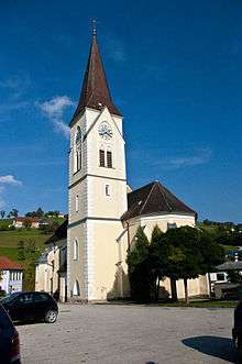
Local church
References
- ↑ Statistik Austria - Bevölkerung zu Jahresbeginn 2002-2016 nach Gemeinden (Gebietsstand 1.1.2016) for Ertl.
- ↑ "Ertl municipal website". Retrieved 18 June 2012.
- ↑ "Ertl municipal website". Retrieved 18 June 2012.
This article is issued from
Wikipedia.
The text is licensed under Creative Commons - Attribution - Sharealike.
Additional terms may apply for the media files.