Emington, Illinois
| Emington | |
|---|---|
| Village | |
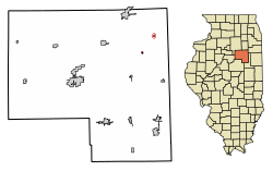 Location of Emington in Livingston County, Illinois. | |
.svg.png) Location of Illinois in the United States | |
| Coordinates: 40°58′13″N 88°21′27″W / 40.97028°N 88.35750°WCoordinates: 40°58′13″N 88°21′27″W / 40.97028°N 88.35750°W | |
| Country | United States |
| State | Illinois |
| County | Livingston |
| Area[1] | |
| • Total | 0.11 sq mi (0.29 km2) |
| • Land | 0.11 sq mi (0.29 km2) |
| • Water | 0.00 sq mi (0.00 km2) |
| Elevation | 709 ft (216 m) |
| Population (2010) | |
| • Total | 117 |
| • Estimate (2016)[2] | 112 |
| • Density | 982.46/sq mi (380.04/km2) |
| Time zone | UTC-6 (CST) |
| • Summer (DST) | UTC-5 (CDT) |
| ZIP Code(s) | 60934 |
| Area code(s) | 815 |
| FIPS code | 17-24062 |
| GNIS ID | 2398828 |
| Wikimedia Commons | Emington, Illinois |
Emington is a village in Livingston County, Illinois, United States. The population was 120 at the 2000 census, as of 2011 it is 117.
Geography
Emington is located northeast of the county seat of Pontiac, and southeast of Odell and Streator, west of Kankakee, about 45 miles south of the Joliet area, north of Bloomington-Normal and Champaign-Urbana. It is located at 40°58′13″N 88°21′27″W / 40.97028°N 88.35750°W (40.970141, -88.357443).[3]
According to the 2010 census, Emington has a total area of 0.11 square miles (0.28 km2), all land.[4]
Demographics
| Historical population | |||
|---|---|---|---|
| Census | Pop. | %± | |
| 1890 | 129 | — | |
| 1900 | 206 | 59.7% | |
| 1910 | 190 | −7.8% | |
| 1920 | 175 | −7.9% | |
| 1930 | 151 | −13.7% | |
| 1940 | 160 | 6.0% | |
| 1950 | 150 | −6.2% | |
| 1960 | 133 | −11.3% | |
| 1970 | 101 | −24.1% | |
| 1980 | 119 | 17.8% | |
| 1990 | 135 | 13.4% | |
| 2000 | 120 | −11.1% | |
| 2010 | 117 | −2.5% | |
| Est. 2016 | 112 | [2] | −4.3% |
| U.S. Decennial Census[5] | |||
As of the 2000 United States Census,[6] there were 120 people, 49 households, and 26 families residing in the village. The population density was 1,184.7 people per square mile (463.3/km²). There were 52 housing units at an average density of 513.4 per square mile (200.8/km²). The racial makeup of the village was 97.50% White, 0.83% Asian, and 1.67% from two or more races.
There were 49 households out of which 32.7% had children under the age of 18 living with them, 36.7% were married couples living together, 10.2% had a female householder with no husband present, and 44.9% were non-families. 38.8% of all households were made up of individuals and 14.3% had someone living alone who was 65 years of age or older. The average household size was 2.45 and the average family size was 3.37.
In the village, the population was spread out with 30.8% under the age of 18, 13.3% from 18 to 24, 28.3% from 25 to 44, 15.0% from 45 to 64, and 12.5% who were 65 years of age or older. The median age was 32 years. For every 100 females, there were 100.0 males. For every 100 females age 18 and over, there were 88.6 males.
The median income for a household in the village was $30,417, and the median income for a family was $31,607. Males had a median income of $30,250 versus $16,875 for females. The per capita income for the village was $12,183. There were 16.1% of families and 12.5% of the population living below the poverty line, including 16.3% of under eighteens and 23.1% of those over 64.
References
- ↑ "2016 U.S. Gazetteer Files". United States Census Bureau. Retrieved Jun 29, 2017.
- 1 2 "Population and Housing Unit Estimates". Retrieved June 9, 2017.
- ↑ "US Gazetteer files: 2010, 2000, and 1990". United States Census Bureau. 2011-02-12. Retrieved 2011-04-23.
- ↑ "G001 - Geographic Identifiers - 2010 Census Summary File 1". United States Census Bureau. Retrieved 2015-08-03.
- ↑ "Census of Population and Housing". Census.gov. Archived from the original on May 12, 2015. Retrieved June 4, 2015.
- ↑ "American FactFinder". United States Census Bureau. Archived from the original on 2013-09-11. Retrieved 2008-01-31.
Municipalities and communities of Livingston County, Illinois, United States | ||
|---|---|---|
| Cities | ||
| Town | ||
| Villages | ||
| Townships | ||
| Unincorporated communities | ||
| Ghost town | ||
| Footnotes | ‡This populated place also has portions in an adjacent county or counties | |