Ellé
| Ellé | |
|---|---|
 | |
| Country | France |
| Physical characteristics | |
| Main source | Brittany |
| River mouth |
Laïta 47°52′15″N 3°32′43″W / 47.87083°N 3.54528°WCoordinates: 47°52′15″N 3°32′43″W / 47.87083°N 3.54528°W |
| Length | 59 km (37 mi) |
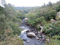
The Ellé is a river in the region of Brittany, western France.[1] Its source is south of the town Rostrenen, in the south-west of the department Côtes-d'Armor. The Ellé flows southwest through the following départements and towns:
At the town of Quimperlé it is joined by the Isole to form the Laïta that flows into the Atlantic Ocean at Le Pouldu. Combined with the Laïta, the river is 76 km (47 mi) long.[1]
References
This article is issued from
Wikipedia.
The text is licensed under Creative Commons - Attribution - Sharealike.
Additional terms may apply for the media files.