Elk Creek (Umpqua River)
| Elk Creek | |
| Country | United States |
|---|---|
| State | Oregon |
| County | Douglas |
| Source | Ben More Mountain |
| - location | near Elkhead, lower Cascade Range |
| - elevation | 1,245 ft (379 m) [1] |
| - coordinates | 43°30′00″N 123°09′37″W / 43.50000°N 123.16028°W |
| Mouth | Umpqua River |
| - location | Elkton |
| - elevation | 82 ft (25 m) [2] |
| - coordinates | 43°38′01″N 123°34′02″W / 43.63361°N 123.56722°WCoordinates: 43°38′01″N 123°34′02″W / 43.63361°N 123.56722°W [2] |
| Length | 46 mi (74 km) [3] |
| Basin | 290 sq mi (751 km2) [4] |
 Map of the Umpqua River watershed | |
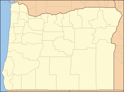 Location of the mouth of Elk Creek in Oregon | |
Elk Creek is a tributary, about 46 miles (74 km) long, of the Umpqua River in the U.S. state of Oregon.[3] The creek begins near Ben More Mountain in the lower Cascade Range south of Elkhead and flows generally north until passing under Interstate 5 in Scotts Valley. It then turns sharply west, flowing through the small city of Drain before meeting the Umpqua at Elkton. Oregon Route 99 runs along the creek for a short distance south of Drain, and Oregon Route 38 follows the creek from Drain to Elkton.[3]
Before its demolition in 1995, Roaring Camp Bridge, a private covered bridge, spanned Elk Creek about 6 miles (10 km) west of Drain.[5] Robert Lancaster built the bridge in 1929 to provide road access to his farm.[6] Added to the National Register of Historic Places in 1979, the bridge was delisted after its destruction in 1995.[5]
Tributaries
Named tributaries of Elk Creek from source to mouth are Shingle Mill, Walker, Adams, Bennet, Cox, Salt, and Wehmeyer creeks followed by Dodge Canyon. Then come Asker, McClintock, Wise, Yoncalla, Pass, Post, and Billy creeks. Further downstream are Hardscrabble, Jack, Parker, Lancaster, Indian, and Brush creeks. Entering the lower reaches are Big Tom Folley, Hancock, and Little Tom Folley creeks.[3]
See also
References
- ↑ Source elevation derived from Google Earth search using GNIS source coordinates.
- 1 2 "Elk Creek". Geographic Names Information System. United States Geological Survey. November 28, 1980. Retrieved February 29, 2016.
- 1 2 3 4 "United States Topographic Map". United States Geological Survey. Retrieved February 29, 2016 – via Acme Mapper. The map includes mile markers along the full length of the creek.
- ↑ "Elk Creek/Umpqua River Watershed Analysis" (PDF). Bureau of Land Management. 2003. p. 1. Retrieved February 29, 2016.
- 1 2 "Oregon National Register List" (PDF). Oregon City County Management Association. November 10, 2005. Retrieved February 29, 2016.
- ↑ Cockrell, Bill (2008). Oregon's Covered Bridges. Charleston, S.C.: Arcadia Publishing. p. 52. ISBN 978-0-7385-5818-9.