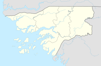
Elia Island
 Elia Island Location | |
| Geography | |
|---|---|
| Location | Cacheu River |
| Coordinates | 12°14′23″N 16°18′18″W / 12.2397°N 16.305°WCoordinates: 12°14′23″N 16°18′18″W / 12.2397°N 16.305°W |
| Length | 10.5 km (6.52 mi) |
| Width | 4.2 km (2.61 mi) |
| Highest elevation | 5 m (16 ft) |
| Administration | |
| Region | Cacheu Region |
| Sector | São Domingos |
Elia Island (Portuguese: Ilha de Elia) is an island in Guinea-Bissau. It is located on the right bank of the Cacheu River close to its mouth in the Atlantic Ocean. The islands's western end lies east of the confluence with the Elia River with Ongueringao Island on the other bank.[1] Its maximum elevation is 5 m and its length 10.5 km[2]
See also
References
External links
This article is issued from
Wikipedia.
The text is licensed under Creative Commons - Attribution - Sharealike.
Additional terms may apply for the media files.