Eldred Township, Jefferson County, Pennsylvania
| Eldred Township, Jefferson County, Pennsylvania | |
|---|---|
| Township | |
|
| |
 Map of Jefferson County, Pennsylvania Highlighting Eldred Township | |
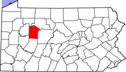 Map of Jefferson County, Pennsylvania | |
| Country | United States |
| State | Pennsylvania |
| County | Jefferson |
| Settled | 1828 |
| Incorporated | 1836 |
| Area[1] | |
| • Total | 46.58 sq mi (120.64 km2) |
| • Land | 46.53 sq mi (120.51 km2) |
| • Water | 0.05 sq mi (0.13 km2) |
| Population (2010) | |
| • Total | 1,226 |
| • Estimate (2016)[2] | 1,194 |
| • Density | 25.66/sq mi (9.91/km2) |
| Time zone | UTC-5 (Eastern (EST)) |
| • Summer (DST) | UTC-4 (EDT) |
| FIPS code | 42-065-22872 |
Eldred Township is a township in Jefferson County, Pennsylvania, United States. The population was 1,277 at the 2000 census. It was named for Hon. Nathaniel B. Eldred, President Judge of the judicial district of which Jefferson County was a part.[3]
Geography
According to the United States Census Bureau, the township has a total area of 46.6 square miles (121 km2), all of it land. There are two unincorporated villages, Sigel and Howe, located in the township.
Demographics
| Historical population | |||
|---|---|---|---|
| Census | Pop. | %± | |
| 2010 | 1,226 | — | |
| Est. 2016 | 1,194 | [2] | −2.6% |
| U.S. Decennial Census[4] | |||
As of the census[5] of 2000, there were 1,277 people, 501 households, and 381 families residing in the township. The population density was 27.4 people per square mile (10.6/km²). There were 873 housing units at an average density of 18.7/sq mi (7.2/km²). The racial makeup of the township was 99.37% White, 0.16% Native American, 0.08% Asian, and 0.39% from two or more races. Hispanic or Latino of any race were 0.16% of the population.
There were 501 households, out of which 30.3% had children under the age of 18 living with them, 66.1% were married couples living together, 7.2% had a female householder with no husband present, and 23.8% were non-families. 19.4% of all households were made up of individuals, and 10.4% had someone living alone who was 65 years of age or older. The average household size was 2.55 and the average family size was 2.94.
In the township the population was spread out, with 22.8% under the age of 18, 6.3% from 18 to 24, 30.1% from 25 to 44, 24.4% from 45 to 64, and 16.4% who were 65 years of age or older. The median age was 40 years. For every 100 females, there were 105.3 males. For every 100 females age 18 and over, there were 101.6 males.
The median income for a household in the township was $36,205, and the median income for a family was $38,945. Males had a median income of $30,809 versus $21,976 for females. The per capita income for the township was $17,596. About 5.7% of families and 8.1% of the population were below the poverty line, including 5.9% of those under age 18 and 6.2% of those age 65 or over.
References
- ↑ "2016 U.S. Gazetteer Files". United States Census Bureau. Retrieved Aug 14, 2017.
- 1 2 "Population and Housing Unit Estimates". Retrieved June 9, 2017.
- ↑ McKnight, William James (1917). Historical. J.H. Beers. p. 457.
- ↑ "Census of Population and Housing". Census.gov. Retrieved June 4, 2016.
- ↑ "American FactFinder". United States Census Bureau. Archived from the original on 2013-09-11. Retrieved 2008-01-31.
Municipalities and communities of Jefferson County, Pennsylvania, United States | ||
|---|---|---|
| Boroughs | | |
| Townships | ||
| CDP | ||
| Unincorporated communities |
| |
| Footnotes | ‡This populated place also has portions in an adjacent county or counties | |
Coordinates: 41°16′00″N 79°04′59″W / 41.26667°N 79.08306°W