El Ejido
| El Ejido | |||
|---|---|---|---|
| |||
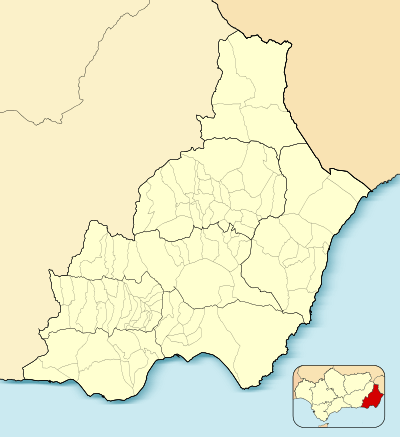 El Ejido Location of El Ejido 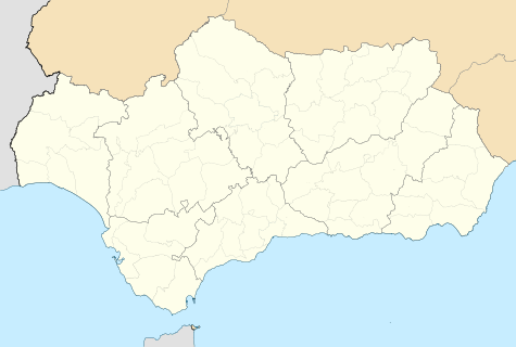 El Ejido El Ejido (Andalusia)  El Ejido El Ejido (Spain) | |||
| Coordinates: 36°46′59″N 2°49′00″W / 36.78306°N 2.81667°WCoordinates: 36°46′59″N 2°49′00″W / 36.78306°N 2.81667°W | |||
| Country |
| ||
| Community |
| ||
| Province |
| ||
| Comarca | Poniente Almeriense | ||
| Municipality | El Ejido | ||
| Government | |||
| • Mayor | Francisco Góngora Cara (PPA) (2015–2019) | ||
| Area | |||
| • Total | 227 km2 (88 sq mi) | ||
| Elevation | 80 m (260 ft) | ||
| Population (2015) | |||
| • Total | 85,961 | ||
| • Density | 379/km2 (980/sq mi) | ||
| Demonym(s) | Ejidense | ||
| Time zone | UTC+1 (CET) | ||
| • Summer (DST) | UTC+2 (CEST) | ||
| Website | elejido.org | ||


El Ejido (Spanish pronunciation: [el eˈxiðo]) is a municipality of Almería province, in the autonomous community of Andalusia, Spain. It is located 32 km from Almería with a surface area of 227 km², and as reported in 2014 had 84,144 inhabitants. El Ejido is the centre of production for fruit and vegetables in the "Comarca de El Poniente". The work opportunities the city provides attract many foreign farmhands, who look for jobs mainly in the greenhouses around. This gives a solid push to its economy. Many of these workers are illegal and do not receive adequate payment and the situation has been characterized as a form of modern day slavery.
Fruit and vegetables from El Ejido are grown using Biological pest control.
In close proximity to the city along the coast line is situated Almerimar, a popular destination for tourism and relaxation.
Demographics
| Historical population | ||
|---|---|---|
| Year | Pop. | ±% |
| 1999 | 51,485 | — |
| 2000 | 53,008 | +3.0% |
| 2001 | 55,710 | +5.1% |
| 2002 | 57,063 | +2.4% |
| 2003 | 61,265 | +7.4% |
| 2004 | 63,914 | +4.3% |
| 2005 | 68,828 | +7.7% |
| 2010 | 85,389 | +24.1% |
| Source: INE (Spain) | ||
Sport
CD El Ejido 2012 is based in the municipality.
See also
References
External links
- (in Spanish) El Ejido - Sistema de Información Multiterritorial de Andalucía
| Authority control |
|---|