Egger Island
| |
|---|---|
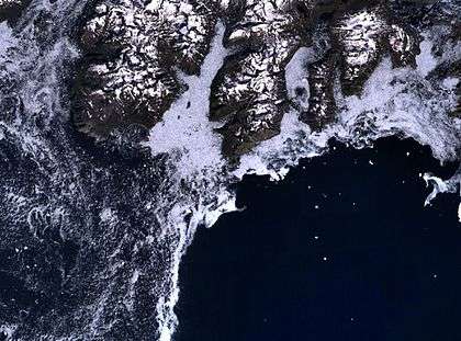 Landsat image with Egger Island's headland Cape Farewell in the centre. | |
 Egger Island | |
| Geography | |
| Location |
North Atlantic Ocean Southern Greenland |
| Coordinates | 59°53′N 43°54′W / 59.89°N 43.90°WCoordinates: 59°53′N 43°54′W / 59.89°N 43.90°W |
| Archipelago | Nunap Isua |
| Major islands | 9 |
| Highest elevation | 903 m (2,963 ft) |
| Highest point | Kuvnerit Mount |
| Administration | |
|
Greenland | |
| Municipality | Kujalleq |
| Demographics | |
| Population | 0 |
Egger Island (Danish: Eggers Ø; Greenlandic: Itilleq, old spelling: Itivdleq)[1] is Greenland's southernmost island. It is located in the Kujalleq municipality and is uninhabited.
Geography
Egger Island is an important landmark for a small islet off Cape Farewell, its southern headland, is the southernmost point of Greenland. It is part of the Cape Farewell Archipelago (Nunap Isua).[2]
The island has a deeply indented coastline and is separated from the neighbouring islands of the archipelago by narrow sounds. Qunnerit lies to the west, Sammisoq to the north and the smaller Avatdlerssuaq and Saningassoq to the east. Egger Island has an area of 308.8 km2 and a shoreline of 150.2 kilometres.[3]
Cape Farewell lies at the island's southernmost tip, with a height of over 2000 feet; it is noted for bad weather.[4]
See also
References
- ↑ "Itilleq". Mapcarta. Retrieved 10 April 2016.
- ↑ "Cape Farewell Map - Greenland - Mapcarta". mapcarta.com. Retrieved 5 January 2017.
- ↑ "UNEP | ITP". islands.unep.ch. Retrieved 5 January 2017.
- ↑ John Paxton (30 December 2015). Statesman's Yearbook World Gazetteer. Palgrave Macmillan UK. p. 200. ISBN 978-1-349-01415-6.